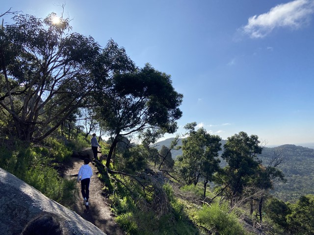
You Yangs East-West Walk (Lara)


The park's distinctive granite peaks rise from the flat volcanic plains between Melbourne and Geelong. Visitors can enjoy magnificent views and bushwalks.
Opening Hours:
You Yangs Regional Park is open every day, including weekends and public holidays. The park is closed each evening.
- Non‐Daylight Saving: 7.00am - 5.00pm
- Daylight Saving: 7.00am - 6.00pm
East‐West Walk - 4.5km, 2 hours return
Starting and finishing at the Turntable car park, this challenging walk provides excellent views of the park and surrounding countryside.
The East-West walk is best done in a clockwise direction. Cross the granite strewn slopes of Flinders Peak as you circumnavigate it. Tall Eucalypt trees give way to views over the flat volcanic plains of western Victoria. Also, see the geoglyph of Bunjil, the creator spirit of the Wathaurung.
Route Details and Map (Walking Maps)

Bunjil Geoglyph
To commemorate the Melbourne 2006 Commonwealth Games, a series of geoglyphs was created by renowned artist Andrew Rogers. The geoglyph on the You Yangs depicts Bunjil, the traditional Creator Spirit of the Wada wurrung Aboriginal people. With a wing span of 100 metres, it uses 1500 tonnes of rock Bunjil is best viewed from Flinders Peak Track. It can also be viewed from the East Walk. Access to Bunjil is from Branding Yard Walk.
Facilities:
There are nine picnic areas throughout the park, many with tables and accessible toilet facilities. The main picnic areas provide free gas barbecues on a first come basis. There are plenty of places to set up your own gas barbecue. Drinking water is available from the Visitor Centre drinking fountain. Please take all rubbish away for disposal or recycling.
Access for Dogs:
There are some nice walks for dogs in the park. Dogs must be on-leash at all times.
History of the Area:
A family group of the Wada wurrung Aboriginal people known as the Yawangi balug enjoyed a rich lifestyle in the You Yangs for thousands of years. The name You Yangs comes from the Aboriginal word 'Wurdi Youang' or 'Ude Youang' meaning big mountain in the middle of the plain.
Granitic rock wells were created by the Yawangi balug as permanent water storage due to the scarcity of natural water in the You Yangs and surrounding areas. Rock wells can be best viewed at Big Rock.
Explorer Matthew Flinders and three of his crew were the first Europeans to see the You Yangs. They climbed to the highest point on 1 May 1802. Flinders named it 'Station Peak' but this was later changed to Flinders Peak in his honour.
Following European settlement the You Yangs were a source of gravel and timber. Tree plantations are prominent throughout the park and the remains of the gravel pits can still be seen.
Getting There:
You Yangs Regional Park is 55km southwest of the Melbourne CBD and 22km north of Geelong. Access to the park from the Princes Freeway is clearly signposted via Lara.
Photos:
Location
You Yangs Regional Park, Branch Road, Lara 3212 Map
Web Links
→ www.parks.vic.gov.au/places-to-see/sites/you-yangs-east-west-walk
→ You Yangs Regional Park - Visitor Guide (PDF)
→ You Yangs Regional Park Map (PDF)
→ Route Details and Map (Walking Maps)


