Wangaratta South - Salisbury Falls Walk

This 4.55km (one way) track makes its way up Mt Warby, starting from the western end of Shanley Street, and on through the Salisbury Falls Gorge before joining the Friends Track to Wenhams Camp, where basic overnight camp facilities are available.
The track is steep in places with many stairs and a moderate level of fitness is required. It can be walked in reverse, or combined with the Alpine Views Track. There are some excellent views of cascades spilling down the escarpment in a series of drops.
Map of Route
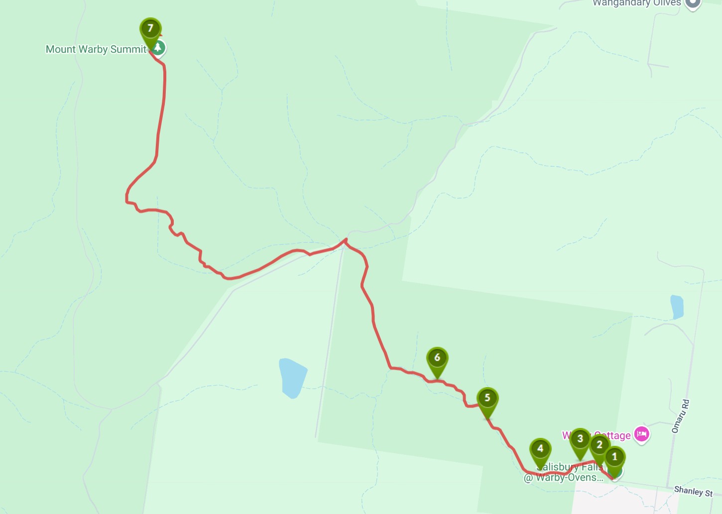
Interactive Map
Points of Interest
1. Entry Point
Salisbury Walk 4.5 kms to Friends Track (Wenhams Camp) one way or 700m walk to falls.
2. Salisbury walk
Point where track splits
3. The track
There is a formed track with lots of vegetation along the way
4. Bush scenery
This is lovely country.
5. Bottom of Salisbury Falls
Salisbury Falls from the lower viewpoint.
6. Looking back down
Worth the walk to see Salisbury Falls from above the pond.
7. Point where track meets Friends Track
Turn and return to Shanley St or continue on to the Friends Track and Wenhams Camp.
Location
475 Shanley Street, Wangaratta South 3678 View Map
Web Links
→ Salisbury Falls Walk (Walking Maps)


")