Wangaratta - Mullinmur Billabong Torryong Track Walk

Mullinmur Billabong comprises approximately 20 hectares of floodplain riparian woodland on the Ovens River and is located 2.5 kilometres north of the Wangaratta City Centre. The 1.5km walk featured here is the Torryong Track.
There are three walking tracks with picnic seating along the way. Besides this track, there is also the slightly shorter Billabong Loop, located a little to the south.
The wetland vegetation of Mullinmur Billabong is dominated by River Red Gums, Silver Wattle, Black Wattle, Sedges, Knotweed and herbs including Joyweed, Sneezeweed, and Carpetweed.
Look out for a range of wetland and woodland birds and during the evening you may catch a glimpse of Barking Owls, Sugar Gliders and Possums emerging from the large old trees that provide hollows and food for many species.
Access to the area is via the corner of Phillipson Street and Cambridge Drive.
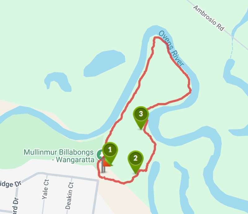
Map of Route
Interactive Map
Points of Interest
1. Mullinmur Billabong Map
Map board showing all the walks. This walk is beside the Ovens river.
2. Track
Beginning of track.
3. Bird Boxes
There are bird boxes in the trees which allow the birds to have protection from the elements and preditors.
Location
Cnr Phillipson Street and Cambridge Drive, Wangaratta 3677 Map
Web Links
→ Mullinmur Billabong - Torryong Track (Walking Maps)
")


")