Wangaratta - Kaluna Island Walk

Close to central Wangaratta, Kaluna Island adjoins is bordered by the King River and one of its anabranches creating an island. Enjoy this short 1.4km loop walk through an 18ha remnant River Red Gum riverine woodland. Many of the trees here are over 300 years old and some have scars that tell ancient stories of their importance to local Aboriginal people.
Look out for Apple Box, a rare species of Eucalyptus in this area, and old River Bottlebrush. There are many beautiful native grasses including large stands of Kangaroo Grass.
The only entry point is for foot traffic over a concrete bridge on the other side of the levee wall at the bottom of Thomas Street, off Wilson Road. This bridge crosses the anabranch and leads to a cleared walking track, which circles the reserve. Access is difficult during periods of high river flow which may last for weeks at a time.
Map of Route
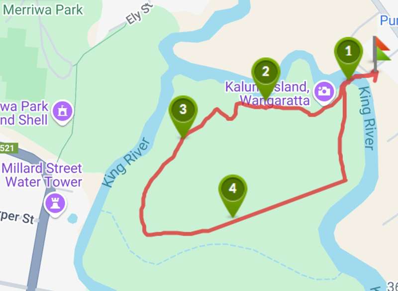
Interactive Map
Points of Interest
1. Entry Point
There is only one entry point to the island and becomes inaccessible when the river rises.
2. View of King River
One of points that you can view the King River
3. The path
The path is a dirt road
4. Beautiful trees
Some of the trees in this area are hundreds of years old.
Location
1 Thomas Street, Wangaratta 3677 View Map
Web Links
→ Kaluna Island Walk, Wangaratta (Walking Maps)


")