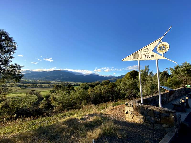
Tawonga - Mount Bogong Lookout


Situated on the Kiewa Valley Highway between Tawonga and Tawonga South, the Mount Bogong lookout has uninterrupted views up Mountain Creek, the Kiewa Valley and up to the summit of Mount Bogong.
There are two unshaded seats at the lookout.
The signage at the lookout includes the following information:
Mount Bogong
MOUNT BOGONG is Victoria's highest mountain at 1986 metres. It forms part of the Australian Alps and is included on the Alpine Walking Track.
There are walking tracks leading to the top which can be completed by walkers of reasonable fitness in less than a day. The best place to start is at Mountain Creek picnic ground, 12 kilometres along a sealed road from Tawonga. There are shorter walks, 15 minutes to 2 hours duration, from the picnic ground and additional Parks Victoria information available at that point.
The First people of the Kiewa Valley and Bogong High Plains
The First People of the Kiewa Valley were the Dhudhuroa. The Yaitmathang occupied the Bogong High Plains. Even though the Dhudhuroa and Yaitmathang peoples were nomadic they had their own country, which was determined by strict boundaries. These were defined by different languages as each clan or group had their own language which was very different between regions. The Kiewa Valley Dhudhuroa groups only had a few common words with the Yaitmathang groups of the Bogong High Plains.
Groups of between 500 to 700 would travel from up to 160 kilometres away to the Southern Highlands of NSW and Bogong Ranges to participate in Bogong Moth ceremonies, which centred on the spring migration of the Bogong moth. The men would ascend up the higher slopes and catch the moths in nets.
The moths were then roasted and winnowed, pounded, and made into cakes which when smoked, would last for weeks. These ceremonies were also used to settle disputes, arrange marriages, and cement alliances between highland tribes.
The impact of European settlement on the First People of the Kiewa Valley and Bogong High Plains was catastrophic and tragic. With the loss of their traditional lands, no immunity to white man's diseases (notably influenza, measles, small pox and tuberculosis) plus alcohol and massacres, the depopulation of the local aborigines was drastic and rapid.
Mission Stations and Reserves were set up across Victoria to provide shelter, food and clothing. One such reserve, Tangambalanga, was occupied by Aboriginal people from a wide area, not just the Dhudhuroa and Yaitmathang groups.
During the 1870's the few remaining First People of the Kiewa Valley left Tangambalanga Reserve and moved to Coranderrk Mission near Healesville, on the outskirts of Melbourne, or Lake Tyers Mission in East Gippsland. Many descendants of the First People of the Kiewa Valley and the Bogong High Plains can trace their ancestry back to Coranderrk or Lake Tyers Mission along with the Tangambalanga Reserve. Today descendants of the Dhudhuroa and Yaitmathang live in North East Victoria and continue to promote and teach the young children their culture and the history of their ancestors.
Kiewa Hydroelectric Scheme
The large pylons and wires which you see crossing the valley carry power from the Kiewa Hydroelectric Scheme to the national grid.
The Kiewa scheme is the largest hydroelectric scheme in Victoria, developed solely for power generation with four power stations having a total capacity of 393MW, sufficient to power approximately 65,000 homes with renewable energy.
Construction began in 1938 and work on three power stations was completed in 1961. In 2005, work commenced on the fourth power station, Bogong. It was the largest hydroelectric scheme developed on mainland Australia in 25 years.
To learn more about the scheme, visit the AGL. Visitor Centre located in Bogong Village - details are available from the Mount Beauty Visitor Information Centre.
Photos:
Location
Kiewa Valley Highway, Tawonga 3697 Map


