Talbot Heritage Walk

Originally the land encompassing Talbot formed part of the native territory of the Jajawurrung tribe (also called Djadjaurrung).
The aboriginal population before the arrival of the British was estimated to be between 900 and 1800. By the 1841 census however, the population had dropped to 282, with the drastic decline due to a combination of 'white man's' disease (principally smallpox) and massacres by early white settlers & alcohol. In 1850 the Protectorate system was abolished, but Edward Parker continued to care for them. Some in the tribe established their own small farms, operating successfully until the gold rush when they were over-run by incomers.
By 1855 the population was down to 100; by the April 1864 Census it was just 23, due to wandering and joining the rushes in other goldfields.
History
Throughout the 1840s there had been rumours of gold found in the area, but the evidence was suppressed. The authorities sought to keep the region as a quiet pastoral district, and feared that a gold rush could spark chaos and lawlessness among the largely convict population.
But in January 1849, an ex-convict called Thomas Chapman found a 38 ounce gold nugget in Daisy Hill Creek (7 km from Talbot) while working as a shepherd. He sold it to a jeweller in Melbourne named Charles Brentani in early 1849.
This was the first confirmed finding of gold in Victoria and it created quite a stir, kicking off a minor rush to the region. By late February 1849 thirty to forty trespassers were reported to have gathered at Thomas's former hut seeking gold before being disbanded by a party of police sent from Melbourne. Meanwhile, Thomas fled to Sydney, fearing trouble after his unauthorised sale of the gold that, according to the law of the time, was illegal.
The first major rush in the area around current day Talbot occurred in December 1852 when gold was found in Daisy Hill, near what is now Amherst Cemetery (2km west of Talbot). News quickly spread and within a few weeks hundreds of miners from the nearby Castlemaine goldfields had arrived to try their luck.
The next major gold find was in 1854 at Kangaroo Flat along Back Creek (1km out of Talbot).
By November 1855 it was reported around 6,000 miners had taken up residence in what became known as Back Creek. But, as the gold dwindled, so too did the population and by end-1857 only a few houses remained. In 1859, a group of miners from Norway and Sweden led by Carl Hallen decided to look in an area just outside of Back Creek, previously thought barren of gold as it was un-forested. Their gamble was rewarded, and as the news spread, miners once again flooded into the area. Within 4 months of the Hallan Party's first shaft being dug, there were 50,000 people in the Back Creek region.
To cater for this influx, streets were improvised in the area of the diggings - starting with what became known as "Scandinavian Crescent" along the edge of the actual diggings themselves. It remains to this day and is now the main street of Talbot.
Today with its wide streets and sweeping curve it looks quaintly graceful. During the 1860s however, the Crescent was an open cut mine of 15 metres deep, 45 metres wide and 650 metres long!
By late 1859, the Census reported that there were around 15,000 people on the Scandinavian field with 5 banks, up to 49 drinking establishments, two breweries, and numerous stores and businesses scattered along six streets.
In 1861, Sir Henry Barkly renamed the town of Back Creek, Talbot, some believe in recognition that the town was situated in the County of Talbot in Victoria.
Key gold era architectural sites include:
- Former Wesleyan Church, constructed in 1862 -1863, now the oldest surviving church in Talbot. Free use of Gothic elements.
- Contrasting sharply with the classically inspired Primitive Methodist Church opposite. ANA Hall, Ballarat Street, next to the town hall, was built 1870-90 for the Australian Natives Association.
- Former Bootmaker, corner Ballarat Street and Scandinavian Crescent, built by Joseph Burdess in 1862. In 1987 the veranda was reconstructed using early photographs as a guide.
- Former Bull & Mouth Hotel, now Chesterfield House B&B, Ballarat Street North, was built of local basalt in 1865 by William Owen. The original Bull & Mouth Hotel was opposite and was demolished to make way for Heales Street. The veranda was added about 1900 when the building was known as the Town Hall Hotel.
- Former drapery, Scandinavian Crescent and Camp Street. This unusual shop and attached residence was built about 1861 when early development consolidated in Talbot. Originally a drapery and later a tea house, by 1919 it was Weilandt's general store. The adjacent shop was built in the early 1920s and has a pressed metal facade, simulating masonry. Now called Slightly Bent Books.
- A guided walking tour of the nearby Amherst Cemetery (which also serves Talbot) is available by appointment. Your tour guide is a trustee of the Cemetery and can provide information about family history research.
Talbot Market Square
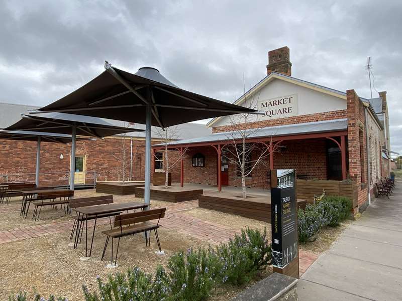
Talbot's meeting place - This was formerly the site of the Lyons Commercial Hotel - a goldrush era building of twenty-six rooms and a residence - between 1861 and 1962. Now repurposed, the Square hosts the monthly Talbot Farmers Market and other community events.
Scandinavian Crescent
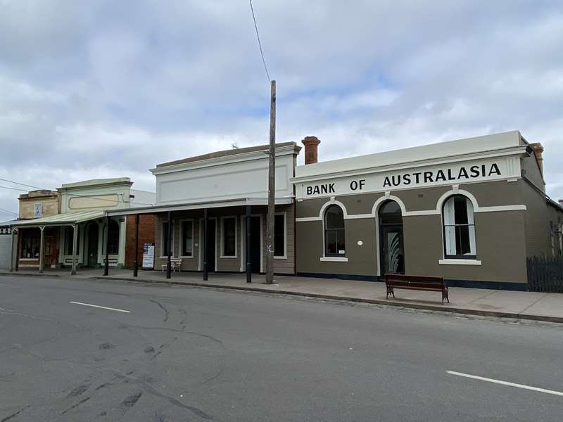
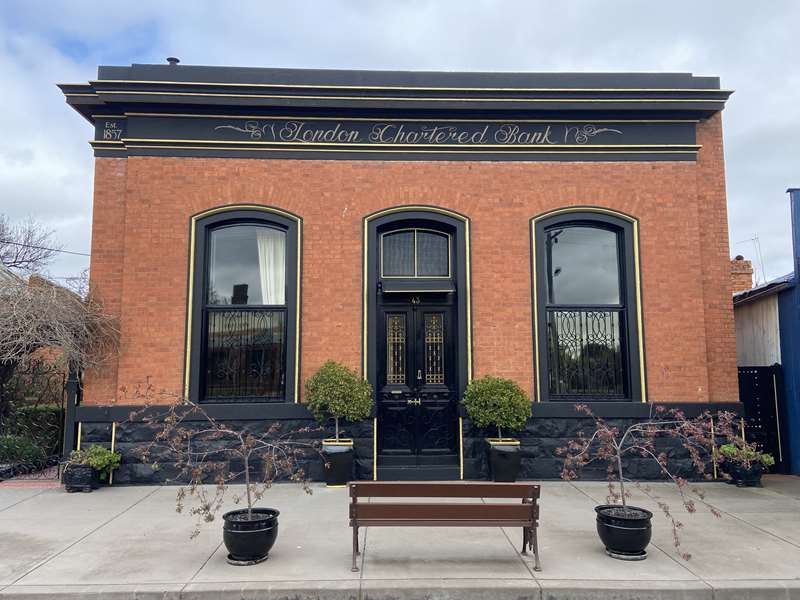
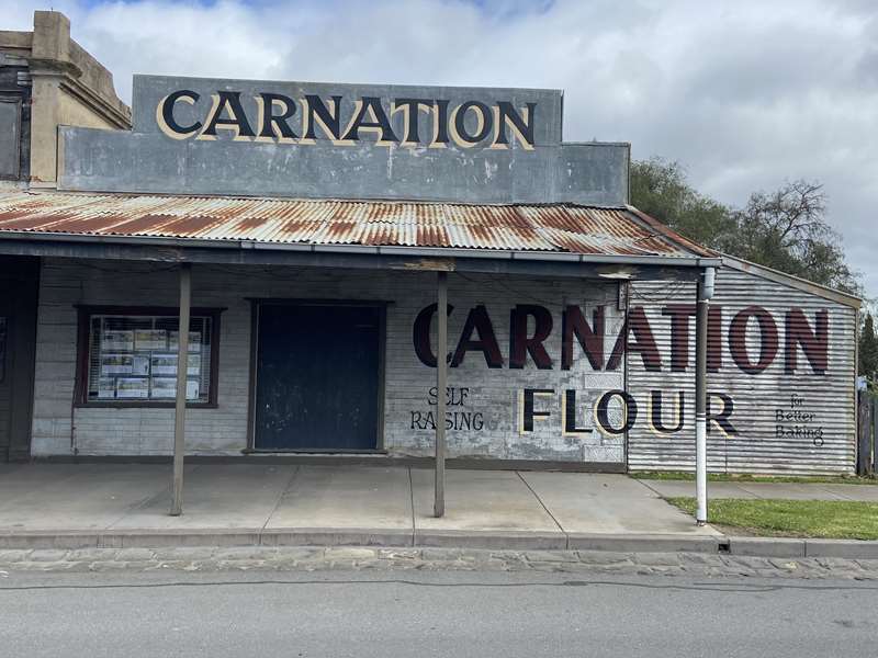
For a time, miners dug frantically across this roadway, but by the 1860s, a rich variety of shops, houses and hotels lined the Crescent.
Over the years, fires destroyed many of these fine structures. By the early twentieth century, miners had moved on and the surviving buildings - banks, shops and private houses - decayed. Young people began to drift away to Ballarat and Melbourne.
Amongst the many Talbot boys who left during the town's decline was Henry Winneke. Henry was born in 1874, the son of a couple who, like many local miners and small-farmers, had emigrated from Hanover in Germany and who had settled in Talbot in 1868. Henry won scholarships to Dookie Agricultural College and Scotch College before going on to a career as a fine sportsman and a judge in the Court of Mines in Ballarat.
Bank of Australasia
Former Goodman's Phoenix Hotel c1870
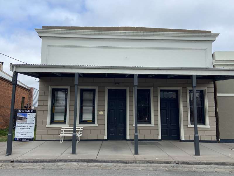
William Goodman, a member of Talbot's small Jewish community, had a billiard saloon on this site by 1861 which was burnt down in January 1869. By 1870, he was described as a publican which indicates that he had re-built by then. The veranda was added in May 1875. The family ran the hotel until its closure in 1923.
No. 35 Scandinavian Crescent
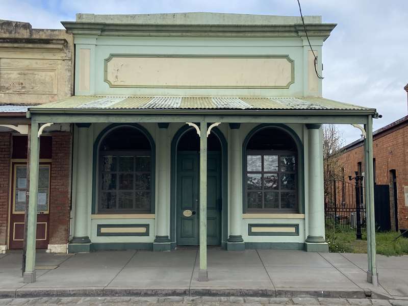
Former Bach's Butcher Shop c1870
Prussian-born Anton Bach (1826-1899) conducted a butcher's shop on this site from 1861. The original shop, probably of timber construction as it was only valued at 20 pounds, was one of eight on this side of Scandinavian Crescent to be burnt to the ground on 26 January 1869. This brick building was probably erected during 1870 and included a two storey rear section which has been demolished. The shop is distinguished by its post-supported verandah and its elegant and elaborate facade, unusual in the local context, and is an important element in the streetscape.
Camp Street
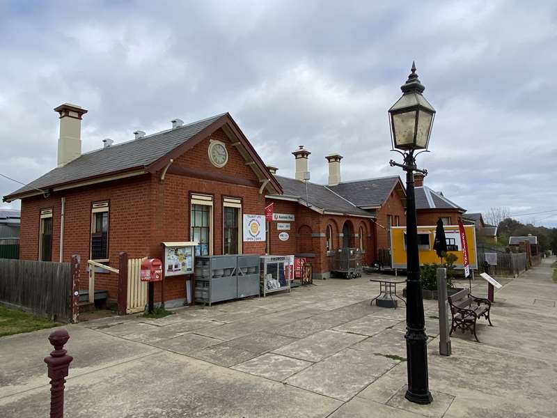
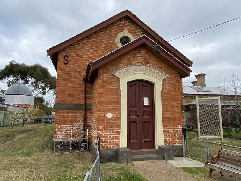
The town of Talbot grew from the thousands of miners who rushed Daisy Hill and Back Creek between 1852 and 1855.
Long before their rush through forests, the land here belonged to the Jajawurrung (Djaja Wurrung) people. From a people of over 1000 in 1840, it is thought that less than 30 Jajawurrung survived in April 1864. By the 1860s, the rowdiest diggers had moved on from Talbot and mining rushes died away. A settled community grew around Camp St with the first Post Office opened in 1860 and a new Wesleyan church planned from 1862. German diggers set up their own Deutscher Verein (German Association). The "speculative go-aheadism which prevails amongst the people of this district" (Talbot Leader, 73 March 1863) produced novel enterprises in and around town. One of Victoria's very early gasworks was built to serve Talbot and the town had a butter factory and soap works. The famous Cohn Brothers, soft-drink manufacturers, was founded in Talbot by Moritz Cohn in 1861.
Town Hall 1862-1871
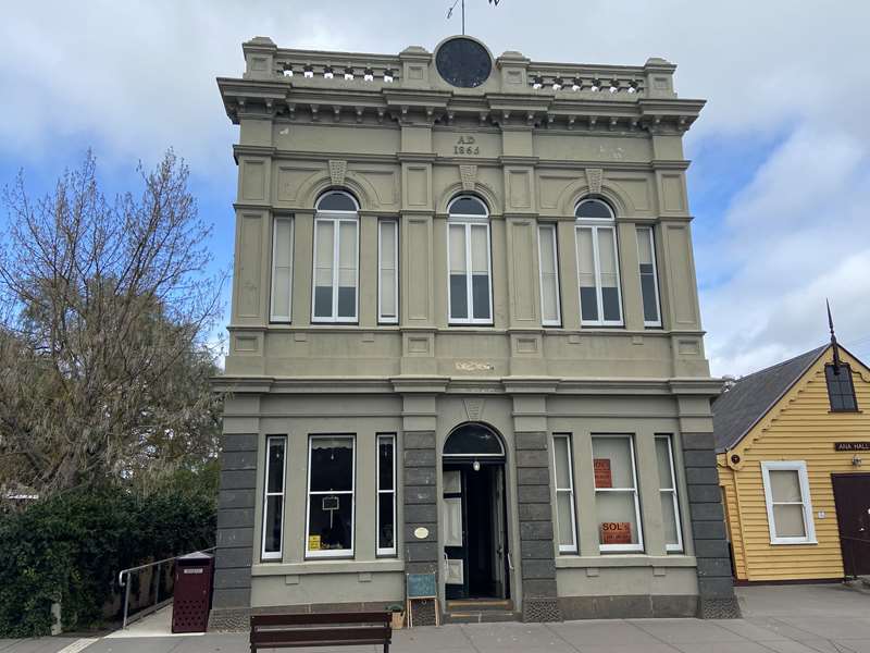
This building was built privately as an Oddfellows Hall in the early 1860s. With the transfer of municipal power from Amherst to Back Creek (later Talbot) in 1861, meetings were held at Back Creek and publican John Medley offered the Oddfellows Hall to the Amherst Municipal Council in 1864. It was eventually purchased for 600 pounds for Council use in 1865.
The Council added the second storey to the facade in 1871 to accommodate its meeting room and a library. Originally the two storey additions also included a turret and clock (since removed). A stage was built in 1873.
The library collection was moved from this location to the first Court House in Camp Street in 1881.
The Olsen brothers, together with Carl Hallen and Joseph Bell hit on the Scandinavian gold lead at New Year in 1859.
The first streets followed the line of this lead with shops and saloons where diggers in Crimean shirts gambled at pool tables and horsemen rode into the bar and took their drinks in the saddle. This rough mining frontier gave way to a settled community by 1865. The more elaborate banks, churches and state buildings date from the 1860s and 1870s. The town hall was first built as the Oddfellow Hall and was bought by the local council in 1865. A new facade was added in 1871.
Many of Talbot's fine public buildings were built by Isaac Meadows, a skilled carpenter and joiner, son of a Lancashire farmer. These included the Amherst Hospital, the Court House and the Presbyterian, Wesleyan and Anglican churches. Originally in -partnership with Thomas Fisher, Meadows built his own building and contracting firm. By the time Meadows died in 1880 his firm had expanded from Talbot and Amherst and was able to win government contracts across Victoria and New South Wales.
Talbot declined by 1900. An English company, Talbot Alluvials, briefly revived mining in 1934 but they too closed in 1940. Bushfires burnt out sections of the town in 1985. One of the earliest campaigns in gold mining Talbot was for a public market. After becoming almost a ghost town following the fires, Talbot now has two successful markets. Together with restored buildings these recapture the exuberance of the rich gold town of Talbot in the 1860s.
London House 1883
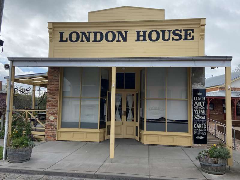
Erected in 1883 by William Phelan, a well-known local building materials supplier, this building replaced the original London House built in Scandinavian Crescent in 1860 - the height of the rush to Back Creek - which had been destroyed by fire on 17 January 1883.
London House was the name of a chain of stores established in Back Creek, Inglewood and other gold rush settlements during the nineteenth century and sold drapery, Manchester and millinery as well as clothing and equipment for miners. The store continued to serve the town as a drapery store until well into the twentieth century.
There is a lovely community garden next to the current London House which is a cafe (42 Scandinavian Crescent).
Photos:
Location
40 Scandinavian Crescent, Talbot 3371 View Map


