Stawell - Grampians Rail Trail


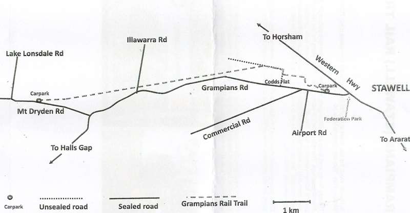
The 11 kilometre (one-way) Grampians Rail Trail starts at a small car park on the Grampians Road, 700 metres south of the Western Highway (near Hines Road intersection).
The trail is quite flat with a fine gravel surface and travels predominantly through picturesque bushland from Stawell towards Heatherlie Quarry.
From the car park at Stawell West, the trail heads west towards the Grampians with the first 2.5km being on a gravel path. The rest of the trail (about 9km) follows the old rail alignment, parallel to the Grampians Road, and then onto Mt Dryden Road, near Lake Lonsdale. The trail includes bridges and a boardwalk. The trail continues onto a car park at Mt Dryden Road.
Grampians Rail Trail Map

Location
Grampians Road, Stawell 3380 View Map
Web Links
→ www.railtrails.org.au/trails/grampians-rail-trail


