St Arnaud - View Point Lookout Cycle Trail

An easy 8km forest ride with excellent views of the St Arnaud township.
Route Description
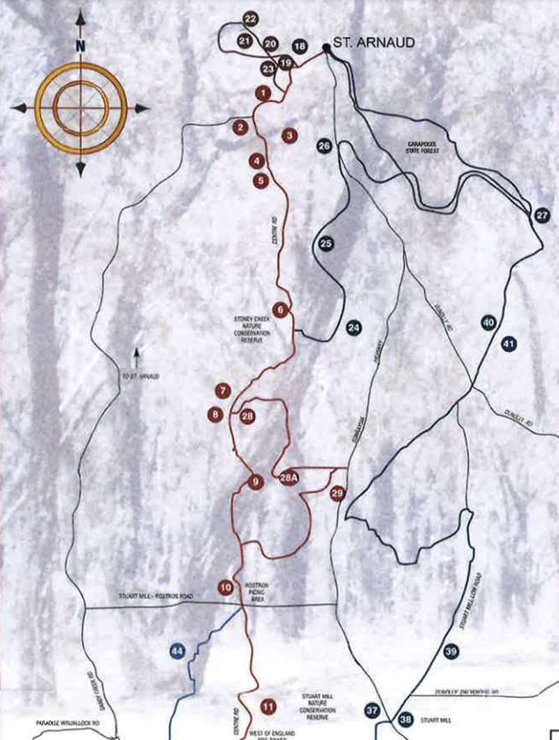
From Queen Street
18. St. Patrick School on left
19. Passion Play site
20. View Point - spectacular views of St. Arnaud
21. Water supply tanks
22. To the right Telstra Tower
23. On your right a superb stand of Grass Trees Goldfields Reservoir
St Arnaud View Point Lookout Cycle Trail Map

Download St Arnaud View Point Lookout Cycle Trail Map
Notes
- Tracks are signposted in the direction of travel indicated on map. Track signposts may not be easily visible in the reverse direction.
- Tracks are usually suitable for mountain and hybrid bikes.
- Routes follow forest and park roads with mostly gentle to moderate grades. However the terrain south of the Rostron/Stuart Mill Road is steep with mountain grades and may require a fair degree of walking.
- Occasional vehicular traffic. Surface conditions vary depending on weather.
- No fires may be lit on total fire ban days including gas or fuel stoves in tents. At all other times fires must comply with CFA regulations.
- Drinking water may not be available outside townships.
- Public toilets are located at St. Arnaud, Teddington Hut, Stuart Mill, Barkley, Moonambel, Teddington Camp Ground, St Arnaud Range National Park.
- The banks of the Upper Teddington Reservoir provide a pleasant venue for camping and picnics. Toilets and fireplaces are provided. Camp only in designated camping areas. Camping is also available at Teddington Fisherman's Hut. (Bookings essential contact Parks Victoria on (03) 5431 7120).
- Varied mobile phone reception is available in some areas with towers located at St. Arnaud and Stuart Mill.
- Snakes are unlikely to be a problem, if noticed, leave alone.
- Please take your rubbish with you for recycling or disposal.
Location
Queen Street, St Arnaud 3478 Map
Web Links
→ St Arnaud Cycle Routes (PDF)


