St Arnaud Historical Locations

Established in the gold rush era of the 1850's, the town has survived the demise of mining with a smooth transition to agriculture, manufacturing and rural industries.
Servicing the population of approximately 2600 and the surrounding district, St Arnaud retains its small town charm with graceful heritage buildings, quiet streets and lovely gardens.
It is recommended you begin your tour of St Arnaud at the St Arnaud Visitor Information Centre Centre (1). Pick up a copy of the St Arnaud Cultural Heritage Trail and use both brochures to gain an insight into the colourful history of the town.
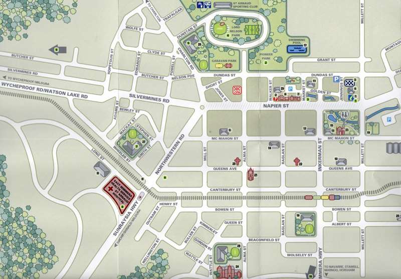
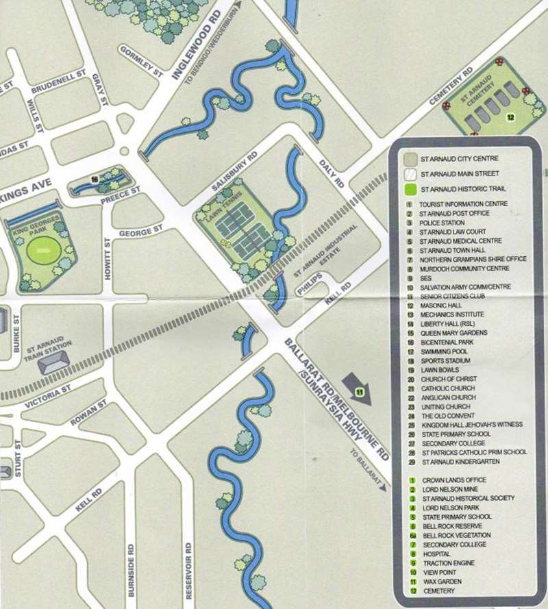
St Arnaud Historical Locations Map
Western part of St Arnaud
Eastern part of St Arnaud and Legend
1. Crown Lands Office
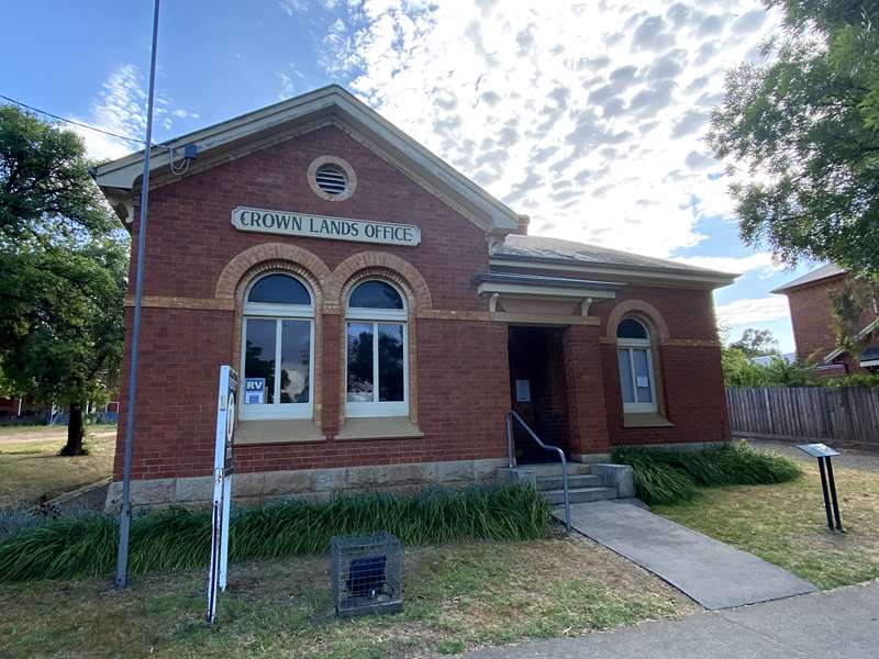
Built in 1876, this well maintained building still boasts the original pressed tin ceilings, slate mantelpieces and moulded archways. It is now the home of the St Arnaud Visitor Information Centre.
2. Pioneer Park & Lord Nelson Mine
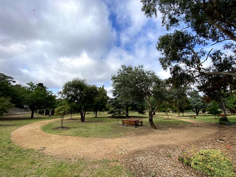
After viewing the historical buildings in Napier St, turn right into Alma St and walk into the Edna Walling designed Pioneer Park. Behind the stone retaining wall lie the remnants of the main shaft of the Lord Nelson Mine. The mine operated from 1884 until 1915, crushing 640,000 tons of stone, which yielded 329,866 ozs of gold - valued at 1,022,584 pounds. The mine reached a depth of 2,599 feet with many tunnels branching out under the school and businesses in the main street. It was said a miner could stand in one of the tunnels and be hundreds of feet under the bar of the Botanical Hotel in Napier Street. When the mine closed in 1915, the mullock was put through a cyanide plant to garner the last particles of gold, leaving huge piles of cyanide tainted sand around the area.
3. St Arnaud Historical Society

St Arnaud's Historical Society and Museum located in the old Turncock's residence, next door to the old fire station which was built in 1883. This is the oldest fire station in Victoria. Inside is the bucket and ladder cart which the firemen used to pull the equipment to the fire. The Turncock's residence is on the left.
When there was a fire he had to rush off and turn on the water supply before the firemen arrived. The Historical Society located at 12 Napier Street also has a research area with access to historically significant documents, cemetery records, and artefacts from St Arnaud and surrounding area's.
4. Lord Nelson Park
Lord Nelson Park was formed from the mining wasteland by volunteer labour. Thousands of tons of soil were carted to level the area which now is home to a sporting arena, showgrounds and a Tabaret complex.
5. St Arnaud Primary School
No. 1646 was built in 1928 on 7 1/2 acres by A.E.H.Preece at the cost 9,999 pounds. This area was also part of the mining mullock heaps and several tunnels ran beneath the school. Trees were planted by volunteers and a sports oval was established. In the 1950's there were approximately 400 pupils enrolled with up to 60 in a class.
6. Bell Rock
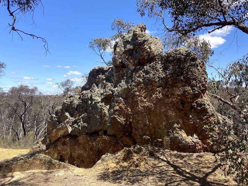
Bell Rock Reserve can be found by following Butcher St for 1 km north of town on Sebastopol Hill.
During the 1860's to early 1900's there were many mines around Bell Rock, the largest of which was the Lady Nelson. The first claim for silver was staked in 1857. A few years later the Alpha Company started operations but failed due to high operating costs.
Soon after, the Freiburg Company was formed. They built a large dam in the gully below the rock and a 24 head battery to crush the quartz from their mine. This mine failed in 1867, was sold and its name changed to the St Arnaud Gold and Silver Mine, managed by Amos Cheale.
On 12th January 1869, Amos Cheale was shot and killed by Andrew Vair outside the mine. A police search was made for Vair but he was hidden by sympathetic miners. Vair attended Cheale's funeral, sitting up in a tree near the grave. Many of the mourners knew he was there but did not give him away. He lived in a tunnel of an abandoned mine for several months, fed by locals. Some 15 months later, he was arrested near Adelaide, tried and hanged at the Ararat Jail in 1870.
The mine was closed shortly after the murder and the crushing plant converted into the Freiburg Flour Mill. A few years later the flour mill was destroyed by fire. In 1885 the ruins of the mill underwent another metamorphosis and became Eckersly's Eucalyptus Distillery, which became famous all over Australia for its 'Blackfellow' Brand oil.
6a. Bell Rock Vegetation
The St Arnaud Field Naturalists have had an interest in the site for years. In 1995 the group were successful in a bid to preserve the flora of the original 'public purposes reserve' and an additional small area to the east of this area. Importantly, this area would now be exempt from mining. The area around this distinctive rock contains a diverse shrub understory which includes an impressive stand of Boronia anemonifolia (Sticky Boronia) and the threatened species, Stipa breviglumis (Cane Spear Grass).
The area also supports what is known as an ecotone. That is, two distinct populations of eucalypt meet here - the box ironbarks give way to mallee eucalypt. The view from Bell Rock picnic area provides a panorama of the cropping country to the north and east of St Arnaud. Spring provides a spectacular sight with a patchwork display of the various crops planted throughout the district. The most vivid is the bright yellow flowers of the Canola crops.
7. St Arnaud Secondary College
Located off Stephen St, this was originally the State School built in 1875 on 5 acres, with an enrolment of 450 pupils and 9 teachers. By 1877, 727 pupils were registered, although only half actually attended. Water was supplied from a well in the front of the school. After WW1 trees were planted in honour of the 3 teachers and ex-pupils who were killed. In 1914 the building was changed to a High School and has since undergone massive grounds and building upgrades. 2014 marked the celebration of of the 100 years of secondary education.
8. St Arnaud Hospital
St Arnaud Hospital was built in 1874 by William Kell at the cost of 2,561 pounds, providing for 10 male and 4 female patients and staffed by a married couple. By 1895 there were 5 wards and 50 beds. Meals in the 1880's consisted of: breakfast - two slices of bread and butter with a mug of tea: dinner was soup, mutton and spuds.
Patients who were well enough were expected to help with the cleaning, etc. Some time later an infectious ward was added. In 1908 the first annual wood bee was held. Many volunteers arrived at the hospital on the day with heavily laden wagons of wood, which was stacked in the grounds for use in the kitchen, etc.
In 1937 a new two storey section was added and a foundation stone was laid by State Premier, Hon. A.A. Dunstan. The top storey was named Osborne House after George Osborne, secretary of the hospital committee for fifty years. The new building cost 26,000 pounds and was built by A.E.H Preece, with provision for 82 patients.
The senior nurses slept inside and the juniors on the verandah, which was freezing during the winter with only canvas blinds pulled down against the elements.
In 1955 the Nurses' Home was opened. It could accommodate sixty nurses. A brick from Florence Nightingale's house in France was placed in the wall.
9. Traction Engine
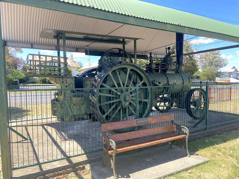
The Traction Engine stands in Apex Park (Sunraysia Highway / North Western Rd). It was the first Marshall steam engine sold in Australia on the 28th June 1888, at a cost of 500 pounds. It was brought to St Arnaud from Melbourne by James Langdon and used until 1943 when boiler tubes were unobtainable due to the war. It was taken from farm to farm and used to power machinery such as chaff - cutters.
10. View Point
View Point (off Wattle Rd) is set on the hill overlooking town and is easily accessible by foot or car. The area is abundant with native wildlife and birds. There is a direction dial pointing to various mountains and it is an ideal location to have a picnic and absorb the scenery
11. Wax Gardens
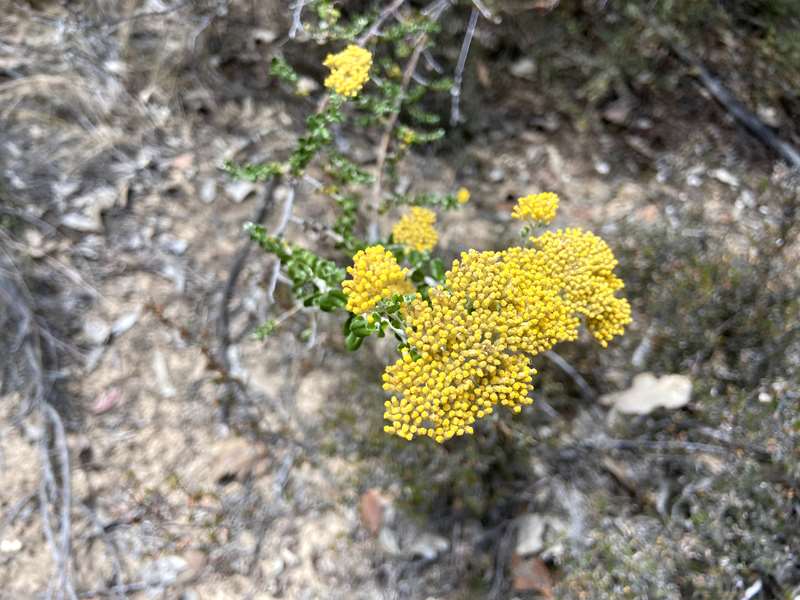
The Wax Garden can be reached either by taking the Sunraysia Highway toward Ballarat, turning into Lock Rd or by turning into Centre Rd from the Wimmera Highway. The best time to visit the garden is in Spring when the flowers are in bloom. The garden covers 3.8 hectares and is maintained by Parks Victoria. The area has always been known to support a dense ground cover, consisting of a wide variety of floral species.
It became known locally as the Wax Garden because of the profusion of the Fairy Wax Flower. Interestingly, this species is now not so prevalent within the reserve. In April 1971, Mr R.W. Handmer, St Arnaud District Forester, recommended to the Forests Commission that the area be protected by a sheep proof fence and set aside as a Flora Reserve.
This was granted in August 1972. In February 1991, the St Arnaud Field Naturalists Club, with the approval and assistance of the Department of Conservation and Environment, began to develop the reserve. Club members compiled species lists, planned and established walking tracks and attached and positioned the species name plates provided by the Department
In 1994, a shelter and notice board were constructed by the St Arnaud Woodworkers Club. Materials were funded by both the Western Victoria Field Naturalists Clubs Association and the St Arnaud Field Naturalists Club. In 2005, Parks Victoria and STAFNC installed a new information display to reflect the Wax Garden's revised status as part of the new Kara Kara Regional Park.
Members of the St Arnaud FNC take responsibility for the information display and update the identification boards as needed. They hope you enjoy your walk through the Wax Garden, and thank you for taking only photographs and memories, and leaving only your footprints.
12. Cemetery
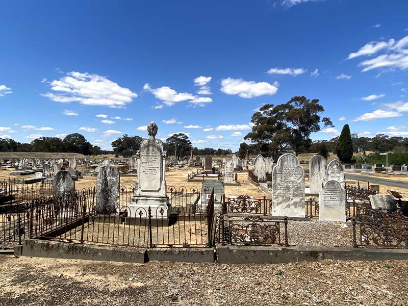
The St Arnaud Visitor Information Centre holds cemetery records for St Arnaud and some of the smaller towns in the district. These are available for perusal by visitors searching for long lost ancestors.
13. Gold Prospecting
Alluvial and shallow reef mining for gold commenced in the St Arnaud area during the 1850's. Today, gold prospecting or 'fossicking' remains a very popular pastime for many visitors to the district.
Recreational fossicking is allowed in some areas of the Kara Kara National Park and the Kooyoora State Park. Fossickers must hold a current Miner's Right. When in State or National Parks, you are not permitted to drive off road and it is wise to check the list of streams and creeks (on websites) in which you are prohibited to pan for minerals. Always obtain a landholder's permission to enter property and back fill any holes you have created. Whether you are a committed fossicker or just out for a Sunday afternoon's entertainment, prospecting can be an enjoyable and rewarding pastime.
Location
4 Napier Street, St Arnaud 3478 View Map


