Skinners Flat Reservoir


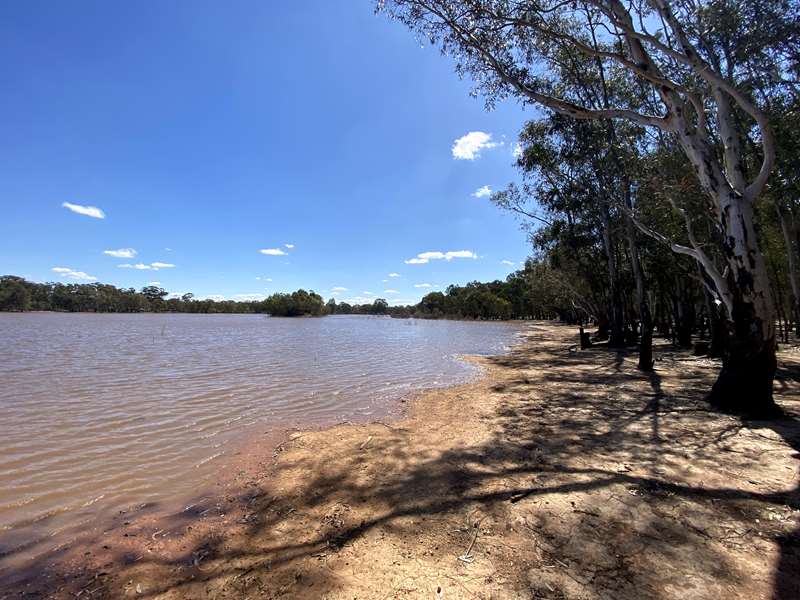
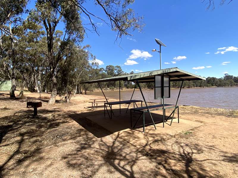
The reservoir offers some great recreation facilities including bush walks, free camping along the entire shore of the reservoir, swimming, fishing, boating with ramp and yabbying. There is a toilet, shelter with two tables which don't have seats, one unshaded table and wood fire barbecues.
The reservoir has an island in the centre and is surrounded by bushland. There are areas suitable for swimming with gum trees lining the shoreline.

Skinners Flat Reservoir is located about 9km north of Wedderburn. You turn off onto a narrow dirt road suitable for a 2WD car to access the reservoir. After 1km you reach the facilities.
Access for Dogs:
Dogs are permitted on-leash. The reservoir is located in the Wychitella State Forest and there are often fox baits laid. Please look out for the signs to protect your dog if you are walking in the bush.
History of Skinners Flat Reservoir
There is an information sign which displays the following test about the history of Skinners Flat Reservoir.
Skinners Flat Reservoir is situated on the Calder Highway approximately 6km north west of Wedderburn. Two catch drains harvest water from areas to the east and west of the reservoir. The largest of these is a channel to the east.
The channel commences in the Wychitella State Forest (on the east side of the Wychitella Road). Both of the catch drains run through private property on easements created in 1939. Skinners Flat also has a natural catchment that extends to Mt Kerang.
Skinners Flat is found in Dja Dja Wurrung country and the first European to come near the area was Major Mitchell, who passed through the vale south of Wedderburn on July 6th 1836. A cairn on the Calder Highway marks this location.
The first squatters arrived five years later. By 1845, many more squatters had arrived, and their runs covered many thousands of acres throughout the Loddon Valley.
The run held in this area was called Torpichen, and it was on part of this run that the first gold of the district was found on May 10th 1852, near the site of the police station in Wedderburn.
Lack of water was a problem during the gold rush and subsequent immigrant settlement. The Korong Diggings became known as a "wet weather goldfield". At first most gold found was surface alluvial, including many large nuggets. But as with many rich Victorian goldfields shafts were sunk and quartz mining carried on.
On March 6th 1928 Mr. R. A. Hill, Korong Shire Engineer, presented the council with a plan showing the location of the proposed new reservoir at Skinners Flat, and a pipeline to connect it to the town supply (located above the existing caravan park). The same year tenders were called for its construction.
The reservoir was built using monkey tailed scoops drawn by two or three horses. These scoops were heavy, and had wooden wheels. At the back was a bent handle ten feet long, hence the name monkey-tail scoops. The total cost for building the reservoir is unknown.
On 25th February 1942 the Shire increased the capacity of the reservoir to between 70,000,000 and 75,000,000 gallons (340 megalitres) at a cost of 1200 pounds.
The work was done by local men on unemployment relief. It involved digging catchment drains to flow into the dam and these channels are still visible. The works alleviated the water problems of the town to some extent, until the present scheme, bringing water from the Grampians became operational in 1950.
Works to improve the Skinners Flat Reservoir has been ongoing over the years. Much of the work has been undertaken by community members volunteering their time.
As the images show - Skinners Flat has a history of activity when water has been abundant. The reservoir continues to be linked to Wedderburn and provides water for sports facilities.
Photos:
Location
Mount Kerang Road, Skinners Flat 3518 View Map


