Pyramid Hill - Hill Walk

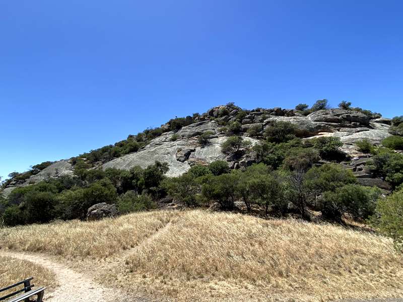
Pyramid Hill is named after the adjacent granite hill with its many interesting rock formations.
A cairn on the southern slopes of the granite pyramid commemorates the explorer Major Sir Thomas Mitchell who discovered and named this area on June 30th 1836 during his journey into "Australia Felix". From the top of the hill, which rises 187m above sea level, there is a wonderful view of the township and surrounding irrigated farmlands.
Hill Walk Map
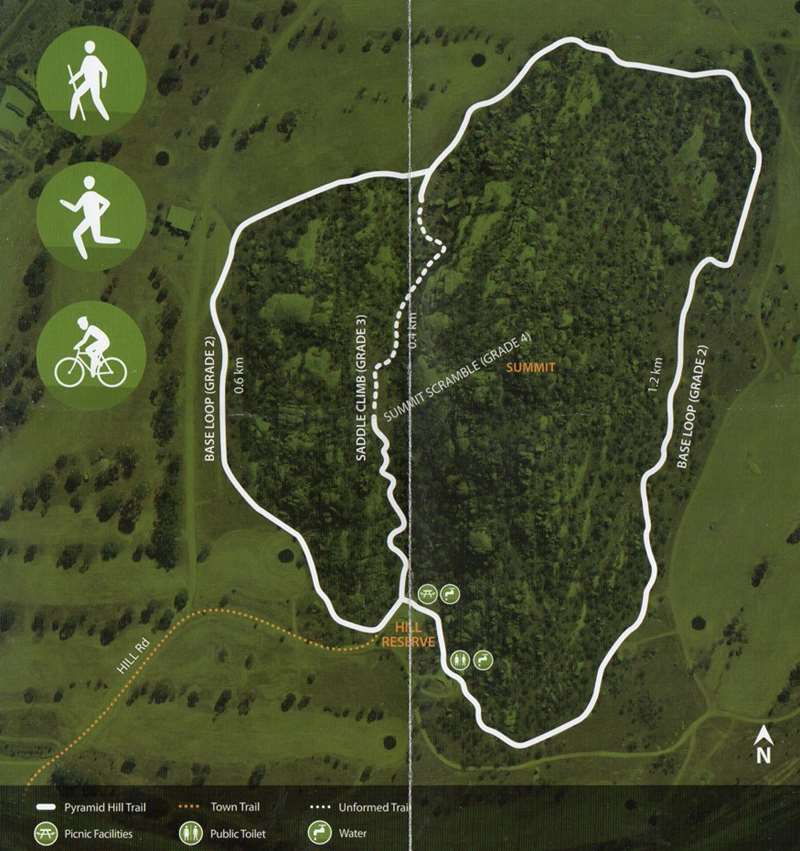
A 2 km safe and attractive pathway winds around the base of Pyramid Hill, linking an existing 3km walk from the town. For the more adventurous the track also extends across the "saddle" of the hill.
Wildflowers abound in the spring and the hill reserve is a popular picnic spot with tables, a barbeque and toilet facilities.
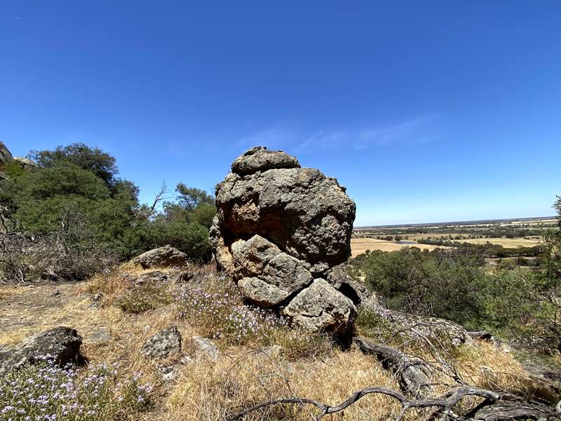
On June 30 1836 Major Thomas Mitchell climbed a granite outcrop rising 187m from the rich soils of the northern Victorian plains and from this vantage point surveyed the surrounding area. He named the mount 'Pyramid Hill', a reflection of its remarkable symmetry when viewed from a distance.
In 1872 a settlement bearing that name was established on the southern side of the hill. With the arrival of the railway in 1885 the growing township was relocated to its current place west of the hill.
From the car park on the southern side of the hill a trail loop of 1.8km takes you around the base of the mount. A 600m return trail also climbs to a vantage point in the saddle where a wonderful view of the township, nearby hills and surrounding farmland is on offer. From the saddle one can return south to the car park, scramble to the summit or continue north on unformed track to meet the base loop trail.
Things to see
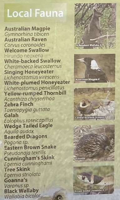
The Plains Grasslands around Pyramid Hill support sparse woodland, a variety of grasses, saltbushes and groundcovers. The hill itself presents a range of microclimates that many plant species have exploited forming Rocky Outcrop Shrubland. Many wildflowers appear at certain times of the year and the vegetation is habitat to a wide range of birds, reptiles and marsupials. Black Wallabies are regularly sighted amongst the Deane's wattle, the most common small tree in the reserve. Birds of prey, including the Wedge-tailed Eagle, find the plains grassland habitats particularly suitable, they nest in tall old gums and utilise the thermal updraft caused by the hill for spotting prey on the plains below. The region also boasts some of Victoria's largest Brolga nesting sites.
Other places of interest nearby worth exploring include Mount Hope to the north, Terrick Terrick National Park to the southeast, Loddon River wetlands to the west and Kow Swamp to the north-east. All may be visible along sections of the trail.
Access for Dogs:
Dogs are permitted.
Review:
The starkness of the boulder filled hill above the surrounding flat landscape makes this an interesting environment for a walk.
At the carpark there are three unshaded tables, seat, information sign, shelter with large tables and BBQ, bins and toilets. We weren't sure about the quality of the water, so it might be best to bring your own water.
The most interesting route is to take the track uphill from near the information sign. In mid November there were a lot of purple Rock Isotome flowering (although it was just starting to fade). When you reach the highest point there is a lookout point with directional marker. If you want to reach the summit a track leads off from this point but it is a tricky uphill scramble which is not for the faint hearted. Otherwise head onwards and downwards along an indistinct track (which does have an occasional marker pole) through the boulders to connect with the base loop track. In this area we saw a wallaby.
For an easier walk you can take the ring track around the base of the hill. This track starts just as you enter the car park area on the left.
At the carpark the sign has the following information:
The Land and People
The rock at Pyramid Hill and surrounding area is granite. This is an igneous rock derived from magma (lava) that has solidified below the earth's surface. It is a very coarse grained rock, predominantly composed of large crystals of quartz, feldspar and mica. The large mineral grains developed under unusual conditions. The parent granite was rich in gases such as steam and compounds containing chlorine, fluorine and boron. These create open spaces in the rock.
Indigenous People belonging to the Baraba Baraba, Dja Dja Wurung and Yorta Yorta Language Groups inhabited this area and still live locally and in the surrounding districts. Pyramid Hill was called Kilmarbil and the Tanne Balug and Yulowil Balug clans were associated with this area.
Mount Hope to the northeast was called Yeerarbil and the Moyberrer Bulloc clan were associated with this area.
Terrick Terrick to the southeast refers to two granite outcrops in the forest visible from a distance, named by the Terrick Terrick People which lived in the area, and possibly meaning Sister Sister.
Sir Major Thomas Mitchell climbed Pyramid Hid in the winter of 1836 and was very impressed with the surrounding countryside. The a northern granite outcrop of the Dividing Range, became a memorable landmark for Major Mitchell and the Settlers that followed.
From atop the Hill, which rises around 192m above sea level, there is a wonderful view of the surrounding farmland, former settlement areas and today's township.
Nestled at the base of the Hill is a picnic area, shelter with wood fired barbecue and toilet facilities.
The walking trails allow a leisurely stroll around the base of the Hill, or a little more demanding walk up and over the western saddle. The trails offer spectacular views, impressive granite formations, and show the beautiful flora and fauna of the area.
The Majors Vision
Excerpt from - Three Expeditions into the Interior of Eastern Australia, Vol 2. By Major Thomas Mitchell.
The Year 1836
THE PARTY QUITS THE MURRAY.
June 29.
The party moved forward in the direction of Mount Hope and, leaving it on the left, we continued towards Pyramid Hill where we encamped at about three-quarters of a mile from its base. We were under no restraint now in selecting a camp from any scarcity of water or grass; for all hollows in the plains contained some water and grass grew everywhere. The strips of wood which diversified the count, seen from the hills generally enclosed a depression with polygonum bushes, but without any marks of having had any water in them although, in very wet seasons, some probably lodges there, as in so many canals, and this indeed seemed to me to be a country where canals would answer well, not so much perhaps for inland navigation as for the better distribution of water over a fertile country enclosed as this is by copious rivers.
PYRAMID HILL. June 30.
Having seen the party on the way and directed it to proceed on a bearing of 215 degrees from North I tended the rocky pyramidic hill, which I found arose to the height of 300 feet above the plain.
BEAUTIFUL COUNTRY SEEN FROM IT.
Its apex consisted of a single block of granite, and the view was exceedingly beautiful over the surrounding plains, shining fresh and green in the light of a fine morning. The scene was different from anything I had ever before witnessed either in New South Wales or elsewhere. A land so inviting and still without inhabitants! As I stood, the first European intruder on the sublime solitude of these verdant plains as yet untouched by flocks or herds, I felt conscious of being the harbinger of mighty changes; and that our steps would soon be followed by the men and the animals for which it seemed to have been prepared. A haziness in the air prevented me however from perceiving clearly the distant horizon from that summit, but I saw and intersected those mountains to the southward which I had observed from Mount Hope.
PYRAMID HILL.
The progress of the party was still visible from that hill, pursuing their course over the distant plains like a solitary line of ants. I overtook it when a good many miles on; and we encamped after travelling upwards of fourteen miles in one uninterrupted straight line. Our camp was chosen on the skirts of a forest of box, having a plain on the east covered with rich grass, and where we found some small pools of rainwater.
July 1.
Proceeding still on the bearing followed yesterday we reached at three miles from our camp a fine chain of ponds. They were deep, full of water, and surrounded by strong yarra trees. Passing them we met a small scrub of casuarinae which we avoided; and we next entered on a fine plain in which the anthisteria or oatgrass appeared. This is the same grass which grows on the most fertile parts of the counties of Argyle and Murray and is, I believe, the best Australian grass for cattle: it Is also one of the surest indications of a good soil and dry situation.
The Old Pyramid Township
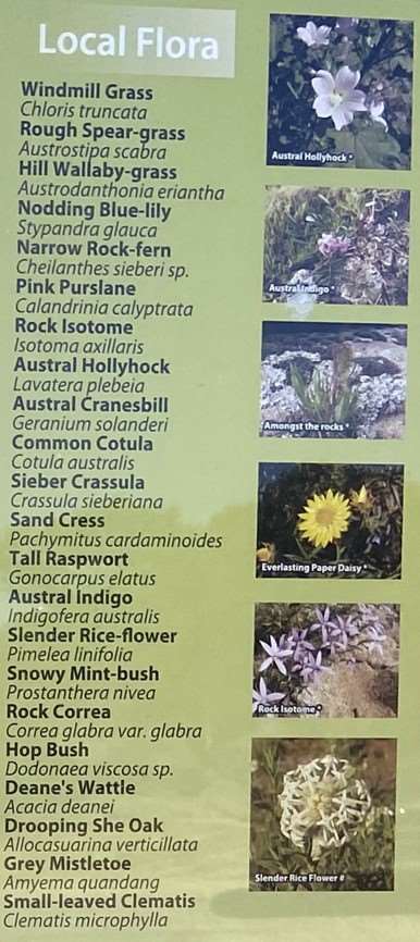
The Chimney behind the Peppercorn trees (Schinus molle) east of the hill is all that remains of the shepherd's but built on the Mt Pyramid Run of the Mt Hope Station.
The Pyramid Hotel, Store and Post Office were built by Thomas Watson on the corner of his selection. The Peppercorn trees in front of the shepherd's but chimney were planted around the Hotel, Store and Post Office. Mail was delivered to the busy Terrick Terrick Township by Coach and forwarded to the Mount. The hotel burnt down in 1926 and the last licensee was Jack Bower.
Gleeson's Store and Singleton's Hotel were also built very close to the hill, but at some stage these two places burned down.
The first school was built west of the Pyramid Hotel, and opened in 1876. It was a simple structure measuring 20 feet by 12 feet. The building was built by locals and simply had two windows, a door and a natural earth floor. It soon became too small. A larger school was built about 1 mile southwest of the original school, near the proposed cemetery.
The Quarry, south of the Cemetery and the second school site, was working as early as 1882. With the approach of the Bendigo-Swan Hill Railway, which was to be located to the west of the Bullock Creek, a spur line had to be constructed across the Creek so the quarry could transfer ballast for the construction of the Rail line. The line to Pyramid Hill was finished in 1884 and the remains of the spur line are still visible.
There was a Blacksmith's south of the School near the Quarry where time honoured skills assisted the building of the railway line.
After the advent of motor cars and the need for better roads the old quarry was reopened and granite material used for road making. In early August 1928 the Pyramid Quarries and Concrete Ltd held an auspicious opening of their works when a large attendance of district residents evinced keen interest in the new industry. The quarry has been in continual operation at its present site since 1937.
Chinese Market Gardeners maintained a garden south of the Hill near the Bullock creek, where there was also a spring near by.
St Patrick's Church was built in 1875 and was situated to the east of the cemetery and west of where the Presbytery stood. In 1923 the Church was moved to its present location in the Pyramid Hill Township, behind where the present building sits.
The Saleyards were north of the Hotel and impromptu horse races were sometimes held on the road in front of the Hotel after the sales had finished.
The Weir was likely built by the 1880's to provide people in the vicinity of the hill a more permanent water supply. Swimming in the creek was a treat for the children and a pedestrian bridge was built across the weir.
Sporting events were held on flat ground west of the weir. Beside athletic events, water sports also occurred. The novelty race consisted of barrels with wooden horse heads propelled by the riders with a paddle. In 1913, on an event gala day, Frank Beaurepaire, who had represented Australia at Olympic Games in Europe, gave instructions and practical displays on life saving.
Later sport meetings were held regularly at the show grounds and involved foot racing, cycling, jumping and tilting the ring, obstacle races, potato races and sack races.
The weir remained until the wet years of the 1970's when it was blown up to let more water go to relieve flooding further upstream on the Bullock Creek.
The Showgrounds were located on the west side of the Hill. The first Agricultural and Pastoral Society Show was held in 1888 when a special train came from Bendigo. The Show was the event of the year and people travelled long distances by horse and buggy to attend. The towns folk displayed their wares - the Coach Building Works had a large string of gigs (a light two-wheeled sprung cart), buggies and phaetons (a sporty carriage), taken to the grounds the day before. Many activities in the arena involved horses. The Showgrounds were used until 1936 when the Mitchell Park Showgrounds were built in the present township.
"The sideshows at the time suggest the absence of anti gambling laws, and consisted of spinning jennys, a wheel of fortune, a man shuffling three cards, another with a trick of the loop, and a table for ringing the coins, besides a fruit and drink stall where a man with a stentorian voice shouted "Lemonade and ginger beer, 3 pence a glass".
Memories recorded of race day by a gentleman who was a child in 1884.
The Racetrack was located between the present Quarry and the Hill. Race meetings were eagerly anticipated as practically everyone had a horse and naturally everyone thought their horse was the fastest. It was an outing for the whole district to look forward to. The Pyramid Hill Jockey Club held an annual race meeting on St Patrick's Day for many years.
The Travellers' hut or Swagman's but was part of the Showgrounds complex and was used by itinerant workers who came around.
The Lions Club of Pyramid Hill ran The Iron Man Contest every year between 1975 and 1989. Events included the infamous hill climb, rope climb, tyre stack, obstacle course, hay bale stack and 2000 metre run.
The Golf Club - Pyramid Hill's picturesque 18-hole sand-scrape course circles the base of the Hill. The Pyramid Hill Golf Club was formed in May 1913 when a nine-hole course was first set out around the hill. It was recorded as being about 1.3 miles in length.
Play was suspended during the First World War and resumed in May 1919 but at a different location, on the property of Mr T. Fawcett. In June 1922 golf returned to the Hill after new links were prepared. This course was also only 9 holes. After this time the course was expanded to 18 holes. In 1966 the course was again lengthened with significant changes made to the layout. The challenging course is 5611 metres for men and 4939 metres for women, with a par of 70 and 71 respectively. Also at this time the original little galvanised iron clubhouse, the scene of many happy occasions and 19th hole blarney, was demolished and a new clubhouse built. The course is open from April to September, green fees are minimal and visitors are most welcome.
Terrick Terrick National Park - One of Victoria's more recent National Park's lies 20km southeast of the township of Pyramid Hill. The park supports over 200 species of native flora including many rare and threatened species. The wooded and open grasslands are home to over 100 species of birds including the Plains wanderer, Grey-crowned babbler, Bush stone curlew, Barking owl, Spotted nightjar and Brolga. The park is also home to a variety of native mammals and reptiles such as the Black wallaby and Tree goanna. The plains area of the park carries a grassy woodland community dominated by white cypress-pine, yellow box, buloke and grey box. In October 2002 the park was expanded to 3.880ha.
Scenic drives take visitors to grasslands, granite outcrops, eucalypt woodlands and historical farming sites. There are many kilometres of multipurpose trails. Like Pyramid Hill, Mount Terrick Terrick picnic area has picnic tables, toilets and park information.
The New Base Loop Trail and Saddle Track
Pyramid Press 31/5/07 - Edit of Report from Pyramid Hill Progress Association
If you have not yet had the opportunity to walk the new track around that beautiful icon our Hill, please do so, you are missing out on an exhilarating experience. The track up to the saddle does require a moderate level of fitness but well worth that magnificent view of our town.
The track around the hill, whilst suitable for a stroll is not so steep but will still get the heart pumping if you pick up the pace a bit. On your way around take the time to observe your surroundings, that awesome rock shows some magnificent markings and if you are lucky enough you may sight some of the wallabies that reside there. Above the 12th and 13th holes of the golf course you get an incredible view of Mawson's Quarry. The track starting from the base of the hill to the saddle is 580m and from there over the hill to the other side is 250m.
If you continue right on the track from there it is 1080m back to the car park at the base of the hill. If you prefer a shorter walk after going up and over the saddle turn left. This takes you pass the golf clubrooms and is 580m back to the car park. The total Base Loop Trail is a mile in length and Saddle Track half a mile.
Photos:
Location
Hill Road, Pyramid Hill 3575 View Map
Web Links
→ Pyramid Hill Trail (PDF)


