Penshurst - Mount Rouse

Penshurst is home to the extinct volcano Mount Rouse. The mountain is a massive accumulation of scoria, rising 100 metres above the surrounding volcanic plain. Mount Rouse is built mainly of red and brown scoria with thin, interbedded basalt lava flows. The scoria forms an mound opening towards the south-west, giving the appearance of a breached cone.
To the south of the main scoria cone is a deep circular crater with a small lake and a smaller shallow crater rimmed with basalt.

Mt Rouse rises 120 metres above the surrounding landscape to, a height of 360 metres above sea level. Major Mitchell first sighted Mt Rouse from Mt Napier in 1836, naming it after the Colonial Under Secretary of New South Wales. It is a beautiful vista, both to those who live at the foot of the ancient volcano in the town of Penshurst and the visitor. From the peak, there are panoramic views of Western District plains.
The mountain bears the scars of past quarrying. Of the four quarries, only one is in current use.
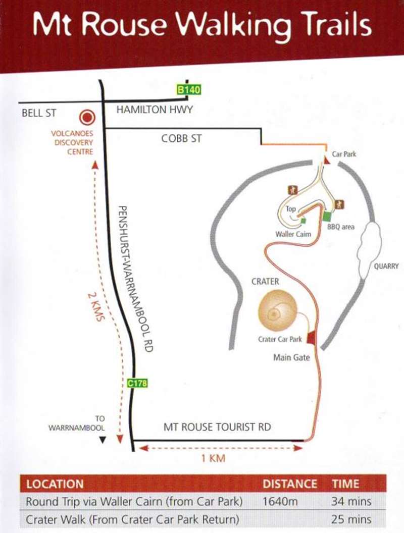
Two walking tracks were constructed along the face of the mountain in 2002 to give increased access. The Mount Rouse summit has track access and provides panoramic views of the lava plain and surrounding district.
Mt Rouse can be accessed by car from Tourist Road, 2.5km south of Penshurst.
Location
Mount Rouse Tourist Road, Penshurst 3289 Map
Web Links
→ The Mount Rouse Volcano (VRO)


