Mount Cole State Forest


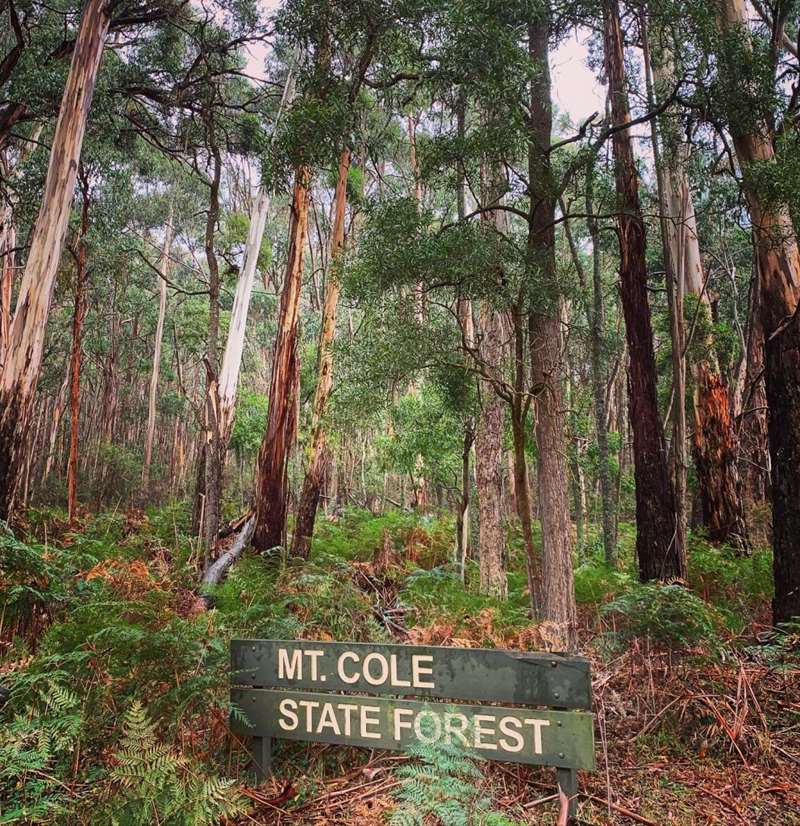
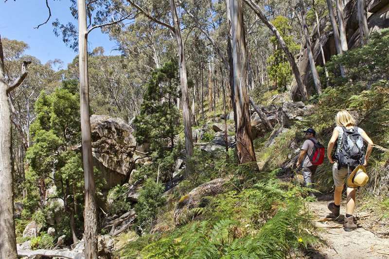
Mt Cole State Forest is a magnificent forest allowing you to go for a walk through cool fern gullies, spectacular tall forests and alpine plateaus with magnificent views for 360 degrees.
Visitors can experience various recreational activities including horse riding, camping, walking, four wheel driving or just enjoy a picnic.
Most sites provide picnic facilities, toilets, shelters and fireplaces/pits. Availability for camping is on a first come basis. There is no charge for camping in the area.
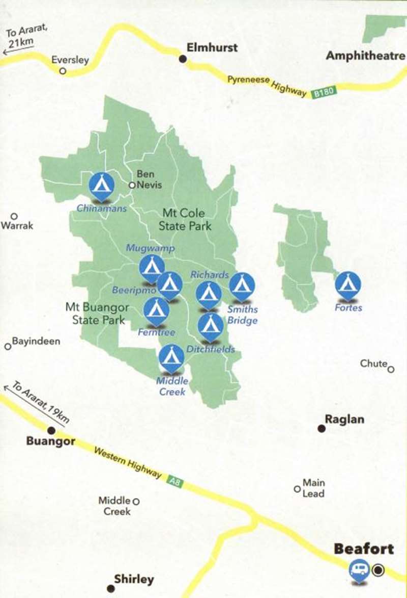
Mount Cole State Park - Mount Buangor State Park Map

Mt Cole State Forest is a walker's paradise. You can spend as little as a few hours to a week - there is a walk to suit everyone. Examples of walks are:
- Beeripmo Walk: Distance 21km: a moderate 11 hour (2 day) walk. Starting at Richard campground is a journey of discovery for the novice and experienced hiker. This walk gives you the opportunity to experience a variety of varied forest environments from lush forests with ferns, the gentle sound of running water from falls, moss covered rocks and weather beaten rocky outcrops - all with magnificent views.
- Grevillea to Richards: Distance 1.8kms: a moderate 30 to 45 minute walk to Richards. Take this short journey from The Glut picnic area through Mt Cole to Richards.
- Borella Walk: Distance 5km: a moderate 3 hour one way walk from Chinamans to Ben Nevis. This walk from Chinamans Campground to Ben Nevis is a bird watcher's delight. It was named in memory of noted local bird observer Max Borella and offers great lookouts. As the walk can be quite steep in places, it is recommended that you take your time to enjoy the views.

- Woods Gully Walk: Distance 1.4Kms: a moderate 40 minute walk.
- Paradise Walk: Distance 9.2kms: a difficult 4 hour one way walk. Starting at Richards Campground, walk on foot tracks through ferny glades, across the Fiery Creek and over board walks. Some steep sections but great views. Walking poles are recommended.
- Richards to Raglan: Distance 1km: a difficult, steep 30 minutes walk climbing through ferny gullies and encompassed by large granite boulders. You can catch your breadth and enjoy the views at the flat top of the cliffs.
- Cave Hill to Sugarloaf: Distance 3.5kms: a moderate 2 hour walk that climbs gently to Cave Hill. The forest changes from tall eucalypt forest with shrubby understorey to open sub albine vegetation. This walk allows you to experience views to the south towards Mt Cole and the western plains.
- Richards, Raglan Rills, Hutchings Track Loop: Distance 5.2km: 3 hours return (moderate). Starting at Richards Campground, a steep walk uphill via the Raglan Falls with a steep and mainly downhill return. This walk provides great views over the Raglan area.
- Sugarloaf to Beeripmo Campground: Distance 1km: a moderate 30 minute walk. A very pleasant stroll!
- Mt Buangor to Grevillia: Distance 6.5kms: a moderate 2 to 3 hours walk past Dawson Rock then descends gradually through regrowth forest before joining and following Long Gully. At Long Gully the tall eucalypts become overwhelmingly taller. This walk give you the opportunity to take time to enjoy the steep gullies lined with large tree ferns.
- Fiery Loop: Distance 3.2kms: a moderate 1 hour walk. Starting from the Raglan-Elmhurst Road, this walk runs alongside the Cave Hill Creek Education Centre for the first 0.5km before joining the loop of the walk passing through mixed species eucalypt forest carpeted with bracken, skirting Cave Hill Creek and Fiery Creek. The area is alive with birdsong and you may also see the occasional black tailed wallaby. Directions: From Beaufort, drive north towards Raglan on the Main Lead Road which turns into the Raglan-Elmhurst Road. After 19.7km (just 0.2km past the Cave Hill Creek Turnoff) pull off the main road to the start of the Management Vehicle Only Track where the walk commences. Ensure you park your car off the track to avoid blocking access for management vehicles.
- Grevillia Walk: Distance 2.2kms one-way: An under 1 hour walk starting from The Glut Picnic Area and finishing at Richards Campground. This is a great walk to stretch your legs and work up an appetite for lunch. The walk can be done as a one way walk or as a return walk if you retrace your steps.
Picnic and Camping Facilities
There are picnic and camping facilities throughout the Mt Cole State Forest catering for both large and small groups. There are six different sites - Ditchfields, Chinamans, Mugwamp, Richards, Smith's Bridge and Beeripmo. These sites provide an ideal base for all activities, e.g., walking, horse riding, etc.Ben Nevis Lookout

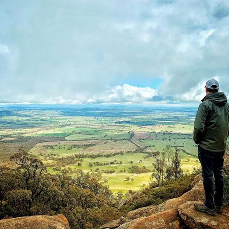
Stop in for a picnic and spend an afternoon exploring Ben Nevis, a striking mountain within the Mount Cole State Forest which offers incredible views over the surrounding peaks, bushland and fields.
Easily accessed via a gravel road which travels right up to the summit. Travel along Buangor-Ben Nevis Road in Mount Cole and turn onto Mount Cole Road which leads runs into telephone E Track and then turn onto Ben Nevis Road. The carpark is equipped with a picnic hut, tables, water tank and toilet so be sure to pack a picnic.
The walk to the lookout from the carpark is a easy short 200m walk. There are some obstacles and uneven ground at the lookout and large drops and cliffs without guard rails so ensure you supervise children at all times.
If you prefer to hike to the lookout, park at Chinamans campground and hike the scenic Borella Walk, known as a birdwatcher's delight and is approximately 5km each way to the look out. The hike is quite steep in places and graded as moderately difficult.
Ben Nevis is a popular destination for rock climbing, with three cliff faces and many climbing options. There is a detailed guide for rock climbing at Ben Nevis over at chockstone.org.
1942 plane crash at Ben Nevis
A monument stands at the Ben Nevis lookout in memory of the tragic victims of a 1942 RAAF Avro Anson plane crash, which occurred on the mountainside blow. The plaque displays the following text:
On the 21st May 1942, an RAAF Avro Anson W2020, crashed below this point.
The following people were on the aircraft.
F Sgt Edward Hope Illingworth
P Off George William Holman
Sgt Denis Aloysius Lenihan
LAC Edwin Cyril Snell
LAC Arthur Edmond Pott (KIA 04 Nov 44)
This plaque was unveiled on the 60th anniversary of the event.
Location
Mount Cole Road, Mount Cole 3377 Map
Web Links
→ Mount Cole State Forest (DSE)
→ Mount Cole Walking Map (PDF)


