Raglan - Mount Buangor State Park


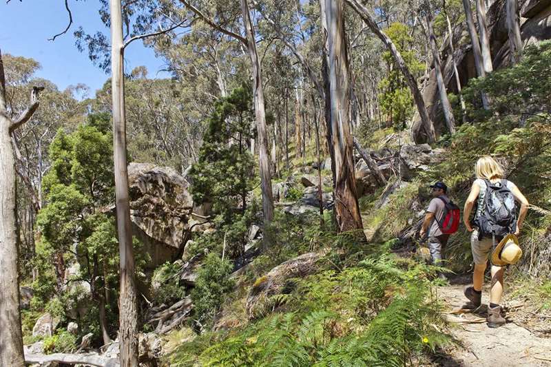
Explore a variety of landscapes including eucalypt forest, creek flats, waterfalls and steep escarpments. From the peak of Mount Buangor, the highest in the area, you can experience spectacular views of the surrounding countryside.
Enjoying the Park
Picnicking
There are picnic facilities at Bailes, Middle Creek and Ferntree.
Camping
Middle Creek accommodates large groups with caravans and individual sites. There are five individual sites adjacent to the Ferntree picnic area.
Walking
A 15km network of walking tracks connect the Middle Creek and Ferntree camping areas. The Waterfalls Nature Walk, which begins at Ferntree picnic area is a short walk suited to everyone. The self-guided walk leads to the Ferntree waterfalls and the upper sections of the Middle Creek area.
Three easier walks to explore include:
Waterfalls Nature Walk - 1km, 45min return (easy/moderate)
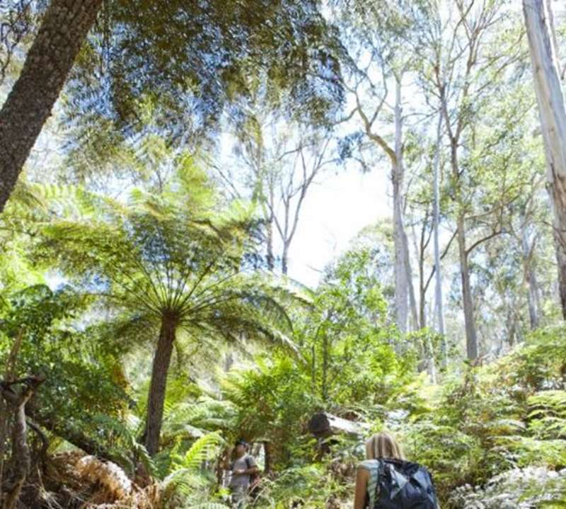
Begins from Ferntree Visitor Area. The track has steep sections - steps and handrails provided. This circuit is an excellent opportunity to experience the beauty of the upper reaches of middle creek, a main tributary which meanders through the park and takes you through many large tree ferns and water ferns. The walk transverses through largely Manna Gum, Messmate and Blue Gum forests and crosses a series of bridges and boardwalks, providing many vantage points.
Cascade Falls is a short 5 minute walk from the Waterfalls Nature Walk. Relax and enjoy the flowing water as it rushes across a large granite rock face.
Two Mile Circuit Walk - 2.9km, 1hr return (easy) from Bailes Visitor Area
2.2km, 45min return from Ferntree Visitor Area. Experience changes in temperature as the walk meanders between Bailes and Ferntree visitors area. The walk crosses Middle Creek twice with its tree fern-lined banks. The remainder of the walk consists of Blue Gum, Manna Gum and Messmate forests.
Middle Creek Walk - 6.2km, 1.5hr return (easy).
Begins from Middle Creek or Ferntree visitor areas. The grade is easy on an undulating track. Linking three visitor areas, the walk follows the creek as it passes through a variety of forest types. Along the way you will encounter some significant Hedcarya trees (Australian Mulberry), Yarra Gums, fern gullies and grassy woodlands. Watch for parrots, wallabies and kangaroos and listen out for the interesting sounds of the bush.
Some longer walks are:
Mount Buangor Walk - 10km, 5hr return (moderate)
Starting at Ferntree Visitor Area, a steep uphill climb takes you past waterfalls, through eucalypt forest to the sub-alpine vegetation at the top of Mount Buangor. Fern-filled gullies and extensive views of the Western Plains past Langi Ghiran await, with a good chance of seeing eagles. The endemic Mount Cole Grevillea may be flowering depending on the time of year you visit. A dramatic panorama unfolds as you approach Mount Buangor Lookout. Beyond the lookout is the Buangor Summit, the highest peak in the region. This peak was formally known as Flagstaff Hill. The name originates from a rock cairn and flagpole that is reported to have been erected by Major Mitchell during his exploration in the area in the 1830s.
Jenny Clayton Walk - 8.3km, 3hr return (easy)

Starting at middle creek campground, a pleasant walk around the Jenny Clayton Education Reserve on the edge of the forest with a good variety of vegetation and animal and bird life. This area of the park has been set aside for education purposes with its diverse display of vegetation communities.
Bukkertillible Walk
Through translation of the local language, Bukkertillible means 'cave'. The Bukkertillible resembles a massive arch, some 100m wide and 15m high. The large angular chunk of granite which lies at the foot of the cave is a stark reminder of what was once a dramatic cliff face. The walk is graded moderate and the track is rocky/steep. Start from either: A. Middle Creek Visitor Area (3.2km 1 hr 30 min return) or B. Bailes Visitor Area (6.3km 2 hr return).
Mount Sugarloaf Circuit Walk

Start from either A. Middle Creek Visitor Area (11.1km 4 hr, 30 min return), B. Bailes Visitor Area (9.8km 3 hr 45 min return) or C. Ferntree Visitor Area (8.9km 3 hr 30 min return). The walk is rated moderate / hard on a rocky/steep track. The walk across the sections of the Mount Cole plateau provides spectacular views across the Western Plains, panoramic views of Langi Ghiran and the Grampians Major Mitchell Plateau in the distance. There are a number of small lookouts which take advantage of these prominent points. The circuit encompasses the Cave Hill cave, a massive granite arch some 100m wide and 15m in height.
Access for Dogs:
Dogs and cats are not permitted in this park.
Location and Access
Access from the Western Highway is via Ferntree Gully Road. Turn right onto this road from Melbourne direction and then follow this to the camping ground car park. The turn is well sign posted.
Note: Photos from Parks Victoria
Location
Ferntree Gully Road, Raglan 3373 View Map
Web Links
→ Mount Buangor State Park (Parks Victoria)
→ Park Note - Mt Buangor State Park (PDF)
→ Mount Buangor Walking Map (PDF)


