Inverloch - Screw Creek Townsend Bluff Estuary Walk


An undulating scenic walk over boardwalks, salt marsh and mangroves up to a lookout on Townsend Bluff with gorgeous views over Anderson Inlet. This is a great walk for kids.
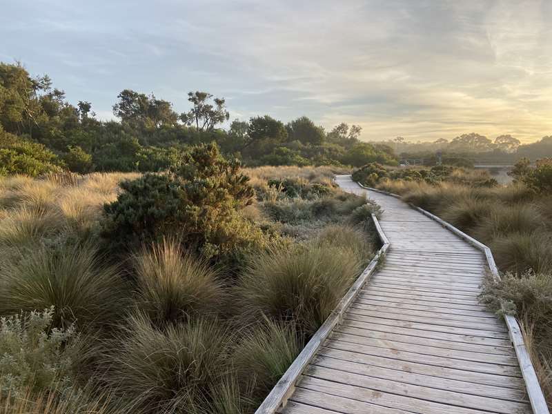
The Screw Creek Townsend Bluff Estuary Walk splits after the bridge at Screw Creek, with the left track continuing on to fishing platforms, and the right track winding up to the Bluff. Enjoy an undulating walk over the boardwalks, saltmarsh and mangroves of Screw Creek, and be rewarded with scenic views over Anderson Inlet from the Townsend Bluff lookout.

Distance: 2.1km circuit
Duration: 50 minutes
Grade: No experience required.
Start: Inverloch Foreshore Camping Reserve car park
Finish: Inverloch Foreshore Camping Reserve car park
Getting there: This track starts at the car park at the end of the road through the Inverloch Foreshore Camping Reserve. This road is a continuation of The Esplanade along the coast to the east of the town.
The diverse nature or the plant communities combined with the stunning view from the top of the bluff gives this reserve its very special character. The walk takes you across an estuarine creek and through coastal dunes, saltwater swamps, Melaleuca thickets and grasslands that are slowly being revegetated.
Please help us protect it by staying on the track, not picking or damaging plants and avoiding revegetation areas.
Walk Notes
1. Dunes (Screw Creek track) Although you may not realise it at first, you are walking through a vegetated dune system - note the sandy soil and the dune vegetation - Coastal Tea-tree, Coast Beardheath, White Elderberry, Bower Spinach, all used as food by Aborigines. As you walk along the path you will notice a gap in the vegetation where a storm in 1995 caused very high tides, inundating this area with salt water and killing the Tea-trees.
Events like these serve to illustrate the dynamic nature of our coastline. A warning - don't try the unripe fruit of the Kangaroo Apple - the Aborigines only ate it when very ripe as the green fruit is poisonous.
2. Saltmarsh Very high tides result in a high level of salt in the sandy soil where saltmarsh plants can grow; dominated here by the Coast Speargrass, which is a tussock grass with sharp pointed leaves as its name suggests. Glasswort, Running Marsh-flower and the native Statice are other plants growing here. Please keep to the boardwalk. It serves two purposes - it keeps your feet dry and protects the marsh plants.
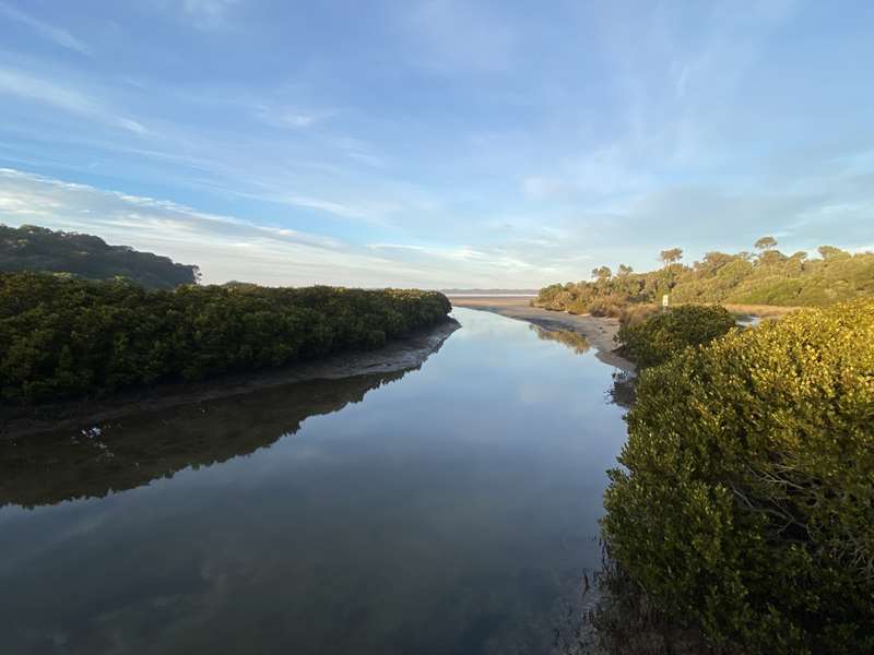
3. The creek The bridge was built in 1971 and upgraded in 1995. The mouth of the creek forms a small estuary flowing into the larger estuary of the Tarwin River, which is Anderson Inlet. Note the White Mangrove, the only southern species of mangrove, with its aerial roots sticking up through the mud to take in oxygen, the seagrass, visible at low water under the bridge, the mudflats, the small crabs and the water birds.

On your right as you step on to the bridge is a bed of the grass Spartina, an introduced weed from America which is spreading across the Inlet and destroying the feeding grounds of many important wading birds.
4. Back on to Dunes The presence of the big Banksia stump across the flat tells us that this was once a Coast Banksia woodland which was probably cut out for firewood in the early days of settlement. There are many interesting sedges, reeds and grasses in this area, including the Coast Sword-sedge, Knobby Club-rush, Blue Tussock-grass and the Common Reed.
Most of these plants were used for basket making by the Aborigines. Other plants you may notice are the native Raspberry with its sweet red fruit and the Small-leaf Clematis.
Melaleuca or Paperbark thickets. These grow in the wetter, heavier soil and are habitat for small Birds and ringtail possums that build their nests in the dense foliage. There is very little undergrowth here because the deep shade inhibits the growth of seedlings.
The Bluff Townsend Bluff is composed of Jurassic mudstone (about 200 million years old) with volcanic intrusions of basalt. The shore platform at the base of the cliff was carved out by sea before the more recent formation of Point Smythe, which is part of the Cape Liptrap Coastal Park, across the water to the south. On the Bluff are depleted stands of Drooping She-Oak and many Drooping She-Oak cone more young trees which have been planted over the last few years. The bluff was once heavily wooded but was cleared for farming soon after settlement.
The view from the top The scene constantly changes as the tide rises and falls. Anderson Inlet forms the estuary of the Tarwin River which can be seen at most tides as a channel winding through the flats below. After heavy rain the inlet's water turns brown with soil washed down from the Tarwin catchment. In recent years Landcare groups have been creating holding dams and wetlands, and fencing and revegetating the rivers and creeks in the catchment to repair the damage caused by earlier farming practices. The eroding rockstack of Eagles's nest, part of the Bunurong Marine and Coastal Park, is an obvious landmark in the west beyond the township of Inverloch. Note the young Blackwood forest re-appearing at the Blackwood cliff top, illustrating the remarkable regenerative ability of the Australian bush, even after years of cattle grazing.
Loh-ern For thousands of years the local Aboriginal people were protected by the dreamtime spirit Loh-ern who protected the Bluff. They camped on the dunes below, on their way to the vast swamps of the Tarwin River where food was rich and plentiful
The Loop track takes you through a young Paperbark Forest, a Kangaroo grass slope and an older Paperbark Forest where wombats live to the main track and back to the car park.. You may see an echidna searching for insects as you walk across the flat.
Access for Dogs:
Dogs are allowed on the walk on-leash but are not permitted on the beach at all.
Regulations:
No horses, no motorised vehicles, no bicycles, no vegetation removal, fires prohibited, camping prohibited, shellfish restrictions apply.
The Sanctuary Zone (North)
Further up the estuary a recently declared new section of reserve has no formed tracks and is an area for observing fauna and flora in their natural habitat. For this reason dogs are not encouraged in this area.
Community input to a planning decision resulted in rural land being rezoned as Public Conservation and Resource. The new section protects a large area of bushland extending up the creek to the Inverloch-Venus Bay Road. Bass Coast Shire has only about 12% of its original vegetation left, so this bushland provides important habitat for many species of birds such as the Golden Whistler and Yellow Robin to breed.
Review:
This is a lovely walk which passes through a range of vegetation zones and scenery. The track varies from wide sandy tracks to more narrow compacted gravel tracks with vegetation arching over the track to a boardwalk and bridge. There is a side branch from the main track to a fishing jetty. There are nice views of the estuary from various points along the walk.
The starting point is a bit strange because you have to drive through the Inverloch Foreshore Camping Reserve to get to the carpark at the start of the walk. Don't be concerned because no-one will stop you. At the carpark there is a very short track to the beach. Anderson Inlet is very tidal and there will be huge variations in the amount of water and sand depending on the tide. At the start point there is a shelter with information signs. The walk is very well signposted and it is almost impossible to get lost.
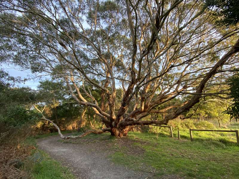
There is plenty of birdlife to see including water birds along the creek and small birds flitting along the track in front of you. Keep an eye out for a massive gum tree which extends over the track. At the top of the bluff there is a seat with views over Anderson Inlet.

A northern section of the park has been added but there are no tracks in this area (yet).
Photos:
Location
Cnr The Esplande and Cuttriss Street, Inverloch 3996 View Map
Web Links
→ Screw Creek Nature Walk
→ Inverloch Screw Creek Nature Walk Guide (PDF)
→ Screw Creek Nature Walk (Walking Maps)


