Heathcote - Walks Around the Town

Heathcote is at the heart of some lovely walking trails suitable for all ages and abilities.
Heathcote Walks Map
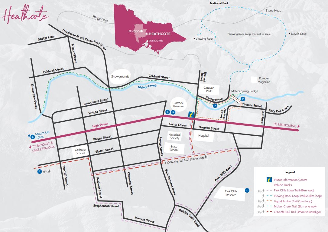
Download map of walks
Valley of Liquid Ambers
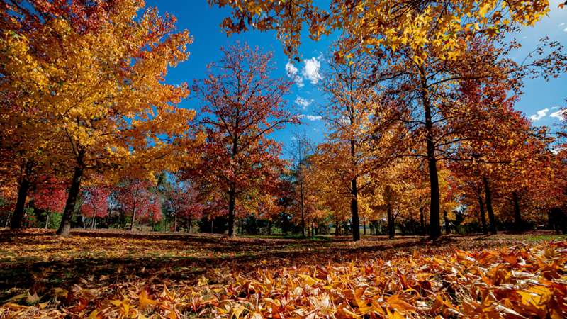
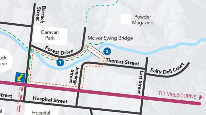
This is a pleasant 1 km loop from the Visitor Centre through to the Liquid Amber trees (dashed orange route on map). Close to the centre of town and adjacent to the Mclvor Creek, the valley is a great spot for a picnic in the rotunda and a leisurely stroll across the swing bridge back into town. Superbly colourful in Autumn!
Mclvor Creek Walk
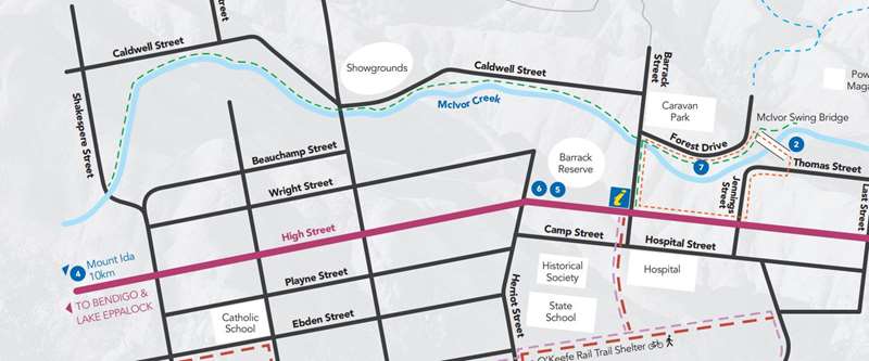
This meandering track (dashed green route on map) follows the pristine creek and runs parallel to the the main street in Heathcote. Fishing and bird watching are both popular here. The trail is approximately 2km one way.
O'Keefe Rail Trail
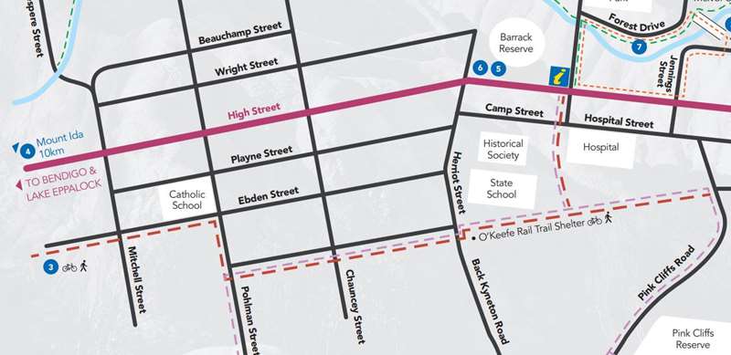
Begin your journey in Heathcote, with the trail starting off at Herriot Street where parking is available. This is the perfect beginning (and potential end!) as its nestled among great cafes, wineries and bed & breakfasts. The trail (thick dashed orange route on map) travels through box-ironbark and yellow gum woodland, as well as sections of farmland. It also crosses waterways such as the Axe Creek, the Campaspe River and Lake Eppalock.
Pink Cliffs Walk
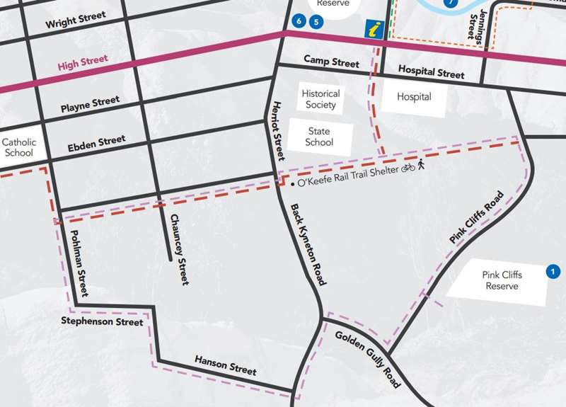
The walking track (dashed pink route on map) takes you on an educational circuit walk, showcasing the stunning geological features of the Pink Cliffs Geological Reserve as well as providing information signs and lookout points along the way. The walk is well signed and directs visitors to both a lower lookout and upper lookout over the stunning pink cliffs.
Mclvor Range
Dotted with tracks to suit all energy levels. Drive to Viewing Rock car park and walk loop around Pannells and Gromans Tracks then Range Drive back to the car park - approximately 8-9kms which takes approximately 3-4 hours. From Nagambie Road, walk the loop along Hylands and Pannells Tracks, 8-9kms taking approximately 3- 4hrs.
Viewing Rock and Devils Cave Viewing Rock
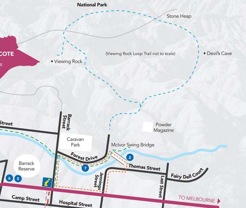
Offers panoramic views of the town and wildflowers in springtime. The track (dashed blue route on map) sets off past the Powder Magazine and up the incline through the forest and up to the rock for a great view of the town. A slight deviation close to the top will bring you to Devils Cave where aborigines and, later gold miners sheltered. The full loop is approximately 2.6km and approximately 1.5 hour return climbing walk.
Forest Drive
This gravel road runs along the foot of Mclvor Range between Barrack Street and Nagambie Road. Several tracks lead off the road up into the range - ideal for wildflowers and general bush walking.
Location
Cnr High Street and Barrack Street, Heathcote 3523 Map
Web Links
→ Map of Heathcote Walks (PDF)


