Enfield - Bald Hills Loop Trail Walk

Reward yourself half way with nice views towards Ballarat and Mount Buninyong from the top of Bald Hill on this 15km walk in the Enfield State Park.
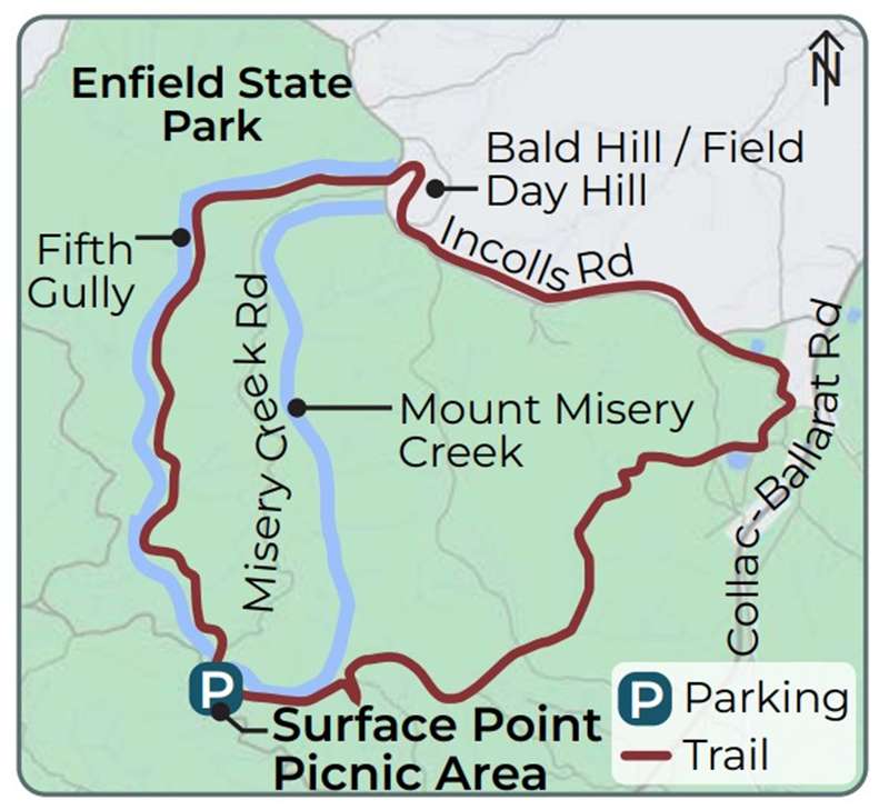
This loop trail begins at the Surface Point Picnic Area carpark and trailhead (off Misery Creek Road). Generally considered a moderately challenging route, the trail is well waymarked and is undulating with some steeper sections that become slippery when wet.
Location
Surface Point Picnic Area, Enfield 3352 Map
")


")