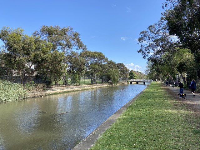
Elwood Canal and Beach Walk (Elwood)


This 5.5km circuit walk starts at Elsternwick Park, follows the nineteenth century Elwood canal until it reaches the bay at Elwood foreshore. The route then continues beside the beach before heading along Head Street and back to Elsternwick Park.
Elwood was originally swampland and was used for waste disposal. The stench became so intolerable that a concrete canal was constructed in 1888. Installation of the Elwood Canal turned it into an area suitable for residential development.
A polio epidemic in 1937-8 caused many panicked parents to label the canal as Plague Canal and ban their children from the vicinity, including the local school which in 1937 closed from June to September. The Melbourne Metropolitan Board of Works responded by widening the upper reaches of Elster Creek to improve the flow.
In April 1970, more attention was drawn to the outlet when Prince Charles swam at Elwood and described the water as 'diluted sewage'.
Landscaping along the canal and its mouth at Elwood beach have transformed the water feature into a centre for recreational activities and Port Phillip Council is continuing to guide its restoration from a drain to an aesthetic waterway.
Map of Route

Route Details
- The route starts at 489 St Kilda Street, Elwood where there is a path which runs to the west on the north side of the narrow canal for 100m.
- Cross the bridge at Foam Street and continue for 350m until you reach Wave Street. Here there is an old dead Aboriginal 'scar' tree. Cross back over to the north side of the canal. The next short section is named Paul Hester Walk. He was a well known musician and a member of the bands Split Enz and Crowded House and a local resident. He committed suicide in 2005 and the path was named in memoriam to him.
- Cross busy Glen Huntly Road. At this point the canal becomes much wider and transitions from being Ester Creek to the Elwood Canal and more influenced by tides. The path continues for 950m and crosses Broadway, Ruskin Street and Addison Street until it reaches Barkly Street. Keep an eye open for the sundial on the side of the canal. Elwood Sourdough is located on Addison Street.
- At Barkly Street, go over the bridge and cross back to the southern side of the canal. Follow the path over Marine Parade to where the path meets the Bay. At this point there is the John Cribbes Footbridge and Bay Trail bridges which provide access to the north. Don't go over these bridges but continue to veer to the south and follow the walker's footpath which runs parallel to the separate Bay Trail cycle path.
- There is a playground on the left and at Point Ormond, there is a small hill with a shipping beacon which provides nice 360 degree views. After re-joining the trail you'll come to toilets and a kiosk.
- Continue for 1km along or beside the beach past various club houses, picnic facilities, toilets, Elwood Bathers Cafe and Elwood Life Saving Club until you reach the Elwood pier opposite Head Street.
- Turn left and follow Head Street along the edge of Elwood Park and Head Street Reserve. Then cross St Kilda Street and continue for about 200m. At this point head north into Elsternwick Park which has a lake, skate park, toilets, playground (at the south end) and another playground (at the north end). This park is a dog off leash area.
- Head through the park to the place where you parked your car. Note: You should be able to find free parking in the area around the start of the walk.
Access for Dogs:
This is an excellent walk with dogs. Elsternwick Park is a dog off-leash area (except for the ovals when they are in use).
Elwood Beach Dog Off Leash Area explains access for dogs which is a bit complicated.
There are bins and water taps along the route.
Photos:
Location
489 St Kilda Street, Elwood 3184 Map
Web Links
→ From Swamp to Canal (skhs.org.au)
→ Elwood Beach Dog Off Leash Area
→ Elwood Sourdough on Facebook
→ Elwood Bathers on Facebook


