Eddington Heritage Walk

Eddington developed at the natural crossing point on the Loddon River on the road between Dunolly and Maldon. Originally a punt operated the crossing but when a bridge was built c1861 and the township was subdivided in 1863, commercial buildings sprang up along McCoy Street, the road to the bridge. Pubs opened on both sides of the river, stores, saleyards, saddlery, bank, stock and station agent, chemist, blacksmith. Business developed along the river to supply the expanding population with the necessities of life - flour, butter, cheese, beer and the bottles to put it in.
When gold mining in the vicinity dwindled and the new river crossing at its current location went ahead in 1926, the township was bypassed and the population decline accelerated.
Today Eddington boasts three flourishing businesses employing over 20 people, and the farms surrounding the town still prosper, despite record flooding after years of drought. The townsfolk continue to take pride in their surroundings, and appreciate the beautiful river.
Follow the map and enjoy an evocative stroll around town to enjoy the town's tranquillity and historic ambience.
Eddington Heritage Walk Map
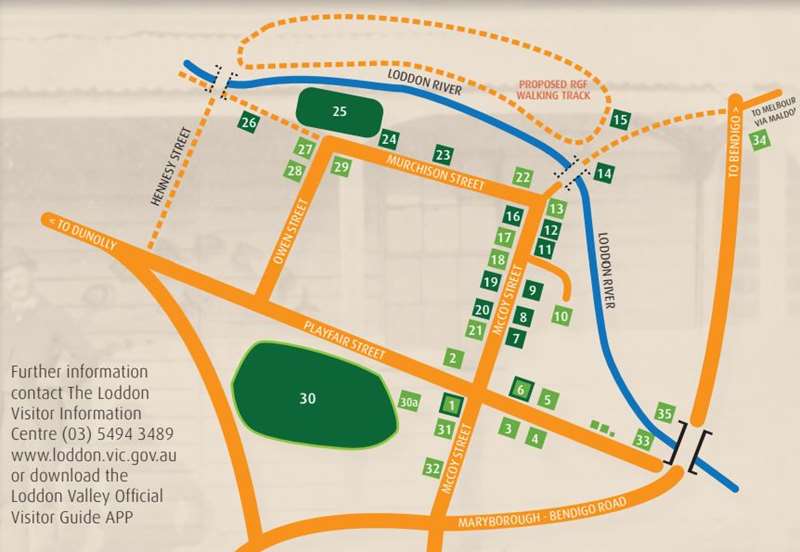
1. Eddington Community Centre.
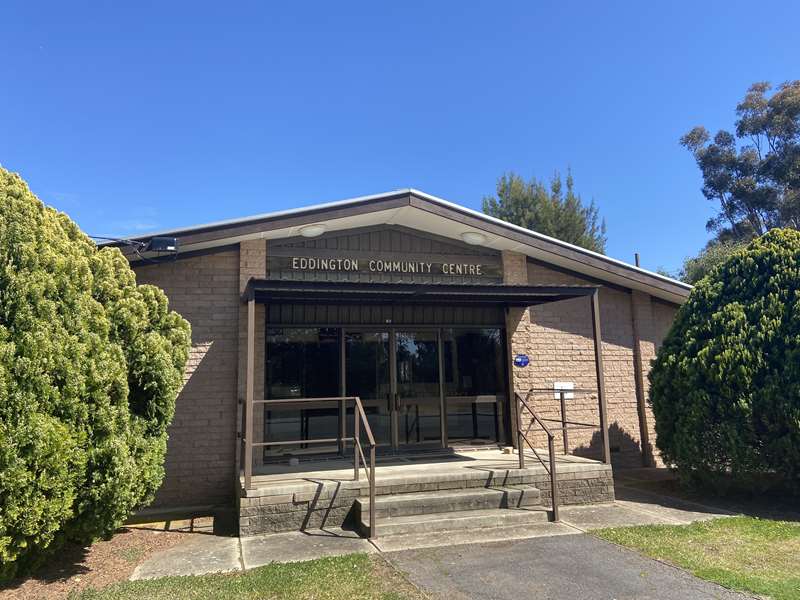
Built by the community in 1984, this well equipped building replaced the old dilapidated Mechanics Institute Hall built in 1893. Although the old hall is gone, the historic backdrop curtain is preserved in the current hall. The original building was opened with a grand ball and the new building opened with a grand ball held in commemoration.
2. Uniting Church
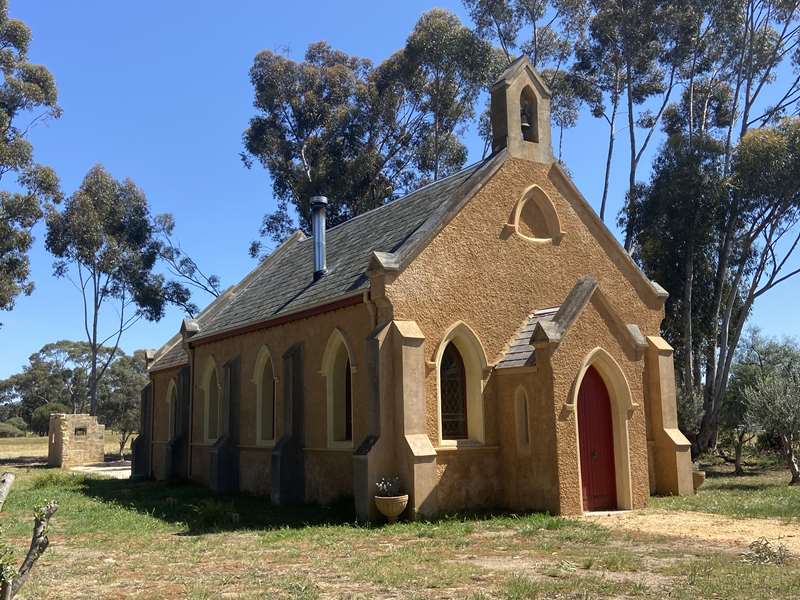
Formerly the St Andrews Presbyterian Church, it dates from 1863 and is in original condition, still without electricity or water supply. The community of the day raised the funds to build the church and the current community has worked hard to repair and maintain the building. It is still used for services.
3. Eddington Common School
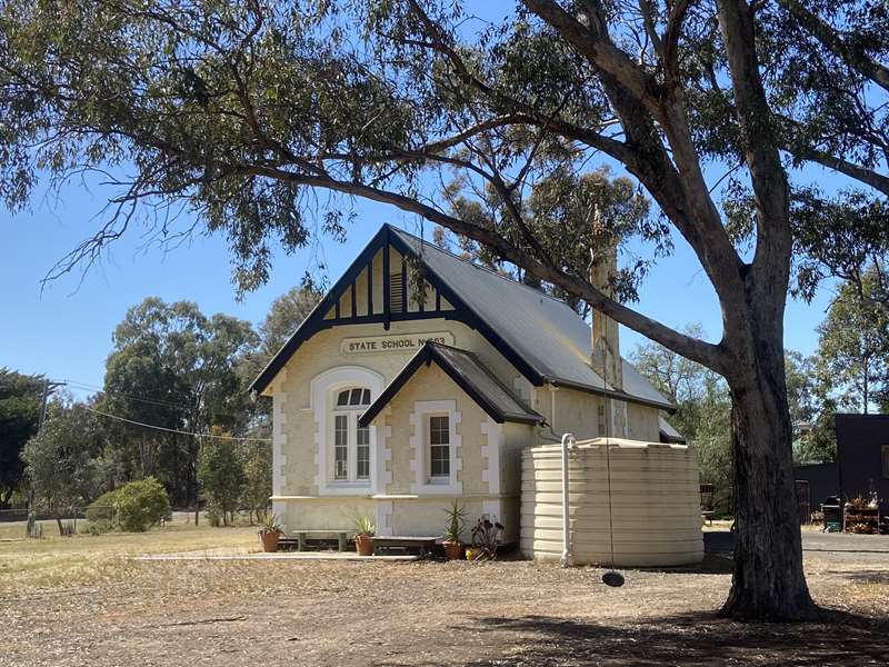
The school was operating in 1865, although the present building dates from 1892, after fire destroyed the previous building. It closed in 1993. Private dwelling.
4. The Schoolhouse Was also built in the 1890s to house the schoolmaster. Private dwelling.
5. Original residence Private dwelling.
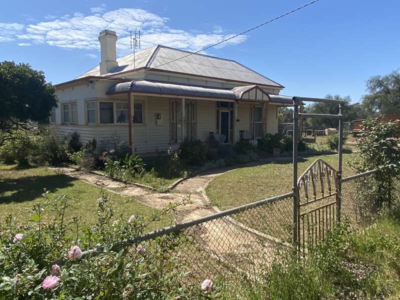
6. Site of Catholic Church A timber building closed for services in 1966 was demolished soon after. Private dwelling.
7. Site of the Primitive Methodist Church, now long gone.
8. Site of Jackson's Chemist.
9. Site of Kilgour's Saddlery.
10. The Police Barracks Built in 1881/2 with its lockups and paddocks for the horses, was de-commissioned in 1934. It is now a unique township farm. Private dwelling.
11. Site of the Commercial Hotel 1860s, the only evidence left are some bluestones, concrete and the deep hole for the well. Closed in 1938.
12. Site of Mayo's Store built in the 1860s, long gone.
13. Bridge Inn.
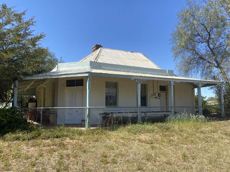
Built in the 1850's by Mayo's, the inn was purchased by the Goulden family in 1868, when it became known as Goulden's Bridge inn. The family owned it until 1966 after being delicensed in the early 1900s. Private dwelling.
14. Site of original Loddon River Bridge.
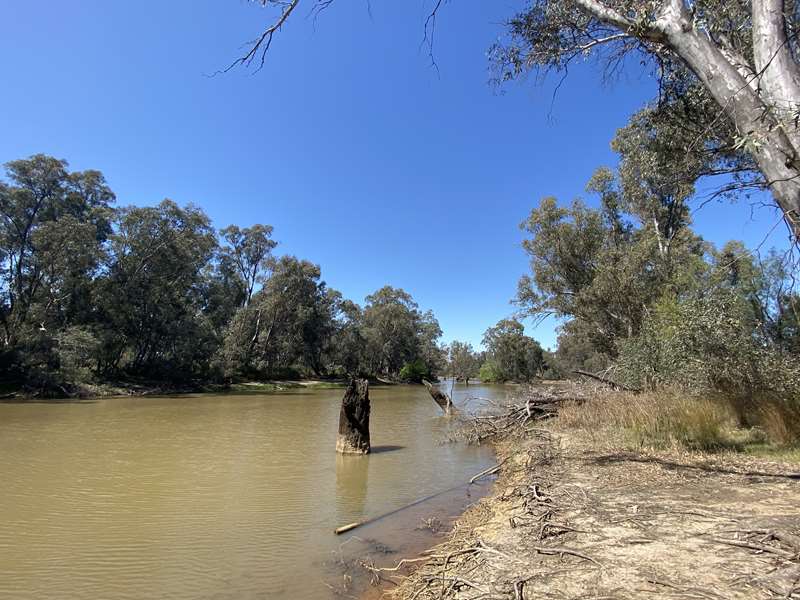
Built in 1861, it replaced the punt at this natural crossing point on the river. Damaged by floods several times, it was never rebuilt on this site after being swept away in 1926.
15. Site of Farmer's Arms Hotel, long gone, on the far side of the old bridge over the Loddon.
16. Site of Eddington Saleyards.
17. Sheehan's Eddington Hotel
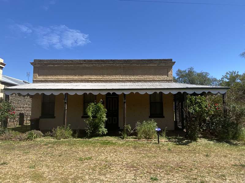
Bought in 1863 by Timothy Ryan when the Township was subdivided, although the hotel may already have existed. It was at one time a change station for the coaches running the Goldfields route. It is referred to in a contemporary 19th century book as serving "the worst beer on the goldfields". It ceased to operate as a hotel in the 1920s. Private dwelling.
18. Post Office and General Store
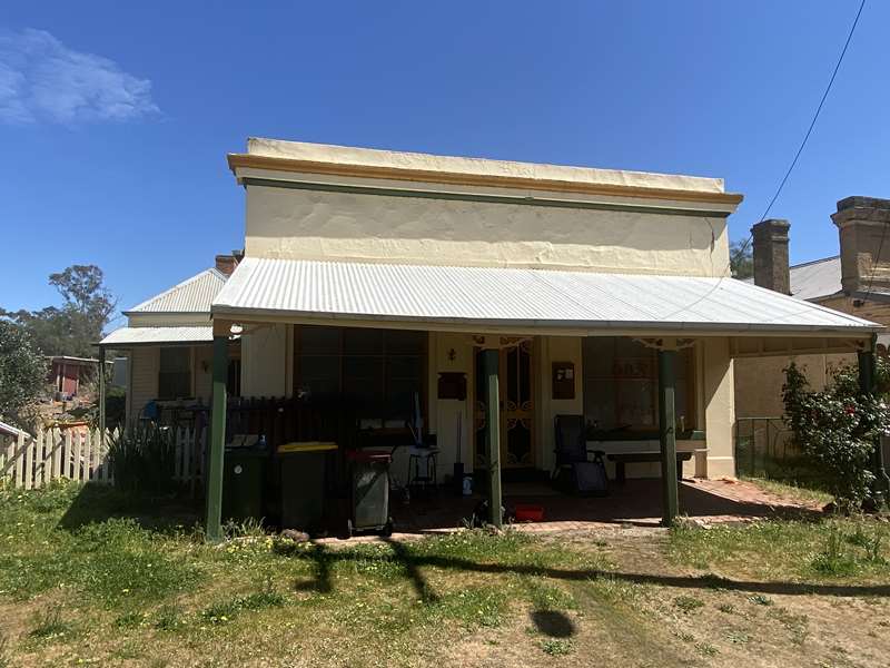
Built in the mid 1850's. It has had many lives, including producing malt for the local brewery. It was also a telegraph station, becoming the telephone exchange and, then a general store which closed in 1969. Private dwelling.
19. Site of Moore's Blacksmith, long disappeared.
20. Site of CBC Bank, long disappeared.
21. Willersdorf & Forbes Stock and Station Agents office. Now known locally as "Arthur's Shack". Privately owned.
22. Loddon Lea
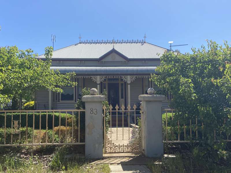
An attractive residence brought from Bendigo to this site in the mid 1970's. Private residence.
23. Site of Gill's Butchers.
24. Site of Sheehan's Flour Mill on the river. The opening of the Laanecoorie Weir in 1899 caused the closure of commercial operations dependent on the river at Eddington due to contamination with mud.
25. Site of the original River Flats Racecourse. A more picturesque location is hard to imagine but it had its drawbacks - prone to flooding, the Reserve was eventually re-located to the current Golf Course site.
26 Site of the Butter & Cheese Factory, which was built in 1884 and operated until 1901.
27. Attractive residence which was re-located to this site from Bendigo in the 70's. Private dwelling
28. Casey's Shack, a private residence, was originally a construction worker's cottage moved from Cairn Curran after the Reservoir was completed in the 1950s.
29. St Paul's Anglican Church.
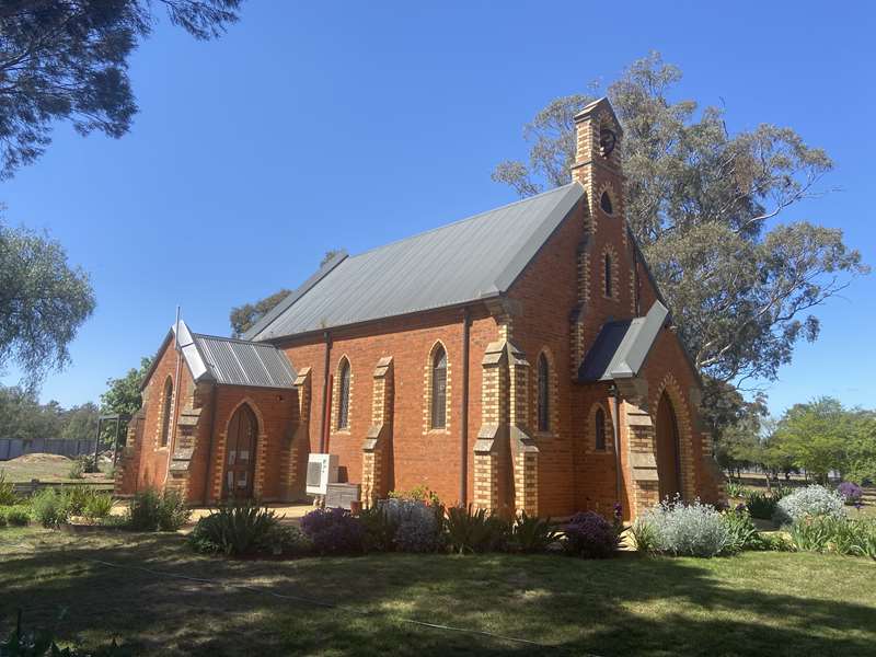
The foundation stone was laid in 1865. Due to declining membership, the church closed in the early 1970s. Private dwelling.
30 Site of second Racecourse and current Golf Course. Now the golf course, this was the site to which the racecourse was moved from the riverside. In recent times it was developed as a testing 9 hole golf course with a thriving club membership.
31 The Reserve & BBQ area provides significant recreational opportunities with access to tennis courts, the golf course and the miniature train track. There are public toilets, including disabled, a playground and a coin operated BBQ with shaded seating. The rotunda was relocated from the school ground when the school closed in 1993.
32 The Loddon Miniature Steam Locomotive track is a significant attraction of the township. Extended in recent years, the ground level track meanders through the gum trees, with sidings and loops making an exciting ride. There is also an above ground track. During the non fire ban season, there are public
runs every 4th Sunday of the month. The thriving club also operates runs for tour coaches, school groups and
children's parties.
33. The Boat Ramp provides access for boats, canoes and fishermen to the Loddon River near the Bridge.
34. The Cemetery. Guarded by an angel, the cemetery contains the graves of early pioneers of the township and district, is still in use and makes an interesting visit. Easily visible from the main road, the entrance is off the Castlemaine/Maldon road.
The Floods of 2011
The floods of January 2011 were the second largest in Loddon Shire's recorded history, surpassed only by a similar disaster in 1909.
They were significantly bigger than the floods of September and December 2010. The fast-flowing waters moved north from the upper reaches of the Loddon River outside the Shire. Newbridge was affected first, then Bridgewater. The floodwaters quickly moved further up the Loddon River and dispersed into creeks and tributaries beyond Bridgewater.
More than 30% - or 2200 square kilometres - of the Shire was impacted. At its peak, the flood was said to be 90km long and 50km wide. Many farms and towns were directly hit and about $30 million worth of damage was caused to Council-managed infrastructure alone. Floodwaters cut roads, including the Calder and Loddon Valley Highways. Phones and power were lost for hours or days at a time.
At the flood's peak, water volumes recorded at the Laanecoorie Reservoir spillway reached 194 gigalitres a day. Melbourne uses 460 gigalitres of water each year.
By March 2011, there were still large areas underwater. New lakes, known as lunette lakes, were formed and these will empty only through seepage and evaporation.
Some, reported to be several hundred hectares in size, are heavily salt-affected. These have generally formed on grain cropping land, which may not return to productive use for many years.
Another smaller flood event occurred in February 2011 as a result of flash flooding and the overflow of the Bullock Creek. This caused further damage to road infrastructure, rural properties and farm and roadside fencing.
Photos:
Location
McCoy Street, Eddington 3472 View Map
Web Links
→ Eddington Heritage Walk Brochure (PDF)


