Daylesford Area Mineral Springs

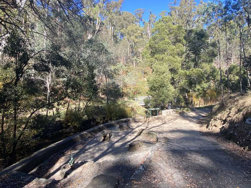
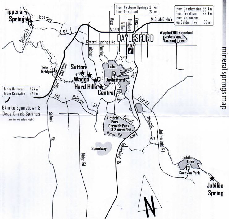
Near Lake Daylesford there are the Central Spring, Hard Hills Spring, Wagga Spring and Sutton Spring. To the north west is Tipperary Spring and there is Jubilee Spring at Jubilee Lake.
Central Springs
History
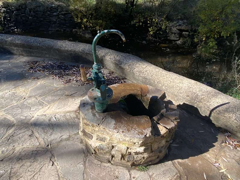
The three hand pumps were installed in the late 1920's. The bores and pumps lie along a bearing of 350 degree true, which would be the strike and fracture lines along the Ordovician rock, near the crest of an anticline of the aquifer.
Hard Hills Spring
History
This deep piped trench with two outlets was discovered in the 1860's by Mr Neil Leggatt, a storekeeper and gold buyer.
Wagga Spring
History
Although believed to have been discovered during alluvial gold mining operations along the Wombat Creek in the 1850's, Wagga Spring cannot be found on tourist maps of the early 1900's. The present concrete pit and steps were installed in the early 1950s.
Sutton Spring

History
William Sutton and his son uncovered this mineral spring while gold mining below Table Hill c1895. The Sutton family originally developed the spring for their own use and hence it became known as Sutton Spring. The family continued to live close by at their home and popular guesthouse 'Tasma' on Table Hill Road.
The mineral springs were usually drawn into a deep hole or pit created with stone walls around the source. The pit required draining with a pipe or opening leading further down the creek. By 1900 a limestone-lined trench had been created, steps cut and a horizontal pipe driven into the "eye" of the spring. Landscaping was gradually installed around these pits to create tranquil seating and picnic areas.
Several bores were sunk near Hard Hill and Sutton Spring to source extra mineral water deeper underground. Hand pumps were fitted to extract the water and provide multiple outlets for the growing numbers of visitors.
Government grants and local funds combined to employ many unemployed workers during the depression years to build many of the stone walls and landscape improvements.
Mr A P Christensen had been mining in the area for many years and he built an embankment by hand across Wombat Creek just east of the Sutton Spring to provide a swimming pool for locals and visitors. It was later used for fishing purposes and demolished in 1931. He had many unfulfilled grand plans for the area including hot mineral baths, hydro-power generation and an electric passenger tramway network.
Note: Closure of the pit spring - Public access to the water from this spring has been restricted for health and safety reasons. This historic spring has been retained for public viewing and mineral water can continue to be collected from the two hand pumps nearby.

Sutton Spring is 400m along the creek from Central Springs. Walking tracks continue north along Wombat Creek to where it joins Sailors Creek and then onto Tipperary Springs, Bryces Flat, the Blowhole and the Breakneck Gorge. Evidence of gold mining abound as you walk along the old water race paths.
How to get to Central Spring, Hard Hills Spring, Wagga Spring and Sutton Spring
The car park at Central Springs is reached by following Central Springs Rd west from the Daylesford Post Office roundabout, then taking Fulcher, the 5th street to the left, to the end. Alternatively, Central Springs Reserve lies next to the Peace Mile, the walk around Lake Daylesford, which can be reached from the Boathouse car park.
Facilities
Shelter, toilets and seats.
Tipperary Spring
History
Tipperary Spring was probably uncovered by miners searching for gold along Sailors Creek and the adjoining gullies. In 1883 the Daylesford Council reported to the Lands Department that there were two springs which were threatened by mining and needed protecting so that the public could benefit from the health-giving properties of the water. The springs were Tipperary Spring and Leggatt Spring, which was later inundated when Lake Daylesford was created in 1929.
How to get to Tipperary Spring
Take the Midland Highway out of Daylesford towards Ballarat. Just out of Daylesford take the right turn marked "Tipperary Springs" just before the Mobil service station. Follow the sealed road as it turns, first to the right, then to the left, then all the way downhill to a turning circle at Sailors Creek, where there's plenty of parking. On this side of the creek is a hand pump, while over the footbridge and to the left is the original piped trench. The spring is also accessible via walking track from Lake Daylesford, or from the Golden Spring via Breakneck Gorge, The Blowhole and Bryces Flat.
Facilities
Shelter, fire places, tables, seats and toilets.
Jubilee Lake Spring
History
Jubilee Lake, originally named Hepburn Goldfields Reservoir, was built in 1860 as a domestic water supply for the Hepburn and Daylesford goldfields. After being destroyed by a flood in 1861 it was rebuilt, enlarged, and named Jubilee Lake in 1887 in honour of Queen Victoria's Golden Jubilee. By 1890 the lake had become polluted and the water unfit for human consumption as this lake had been a popular pleasure resort for many years. The mineral spring was not discovered and developed until 1900.
How to get to Jubilee Lake Spring
Take the Ballan/Mel bourne road from the Daylesford Post Office roundabout. 1.2km from the roundabout you will see the Jubilee Lake Rd turnoff to the left. Follow this road for another 2.7km to the Jubilee Lake caravan park turnoff. Drive through the caravan park and park next to the kiosk. Walk to the edge of the lake and turn right onto the nearby track. Continue along the south bank of the lake, passing the pedestrian bridge which links to the tracks on the other side. Pass through a small gate, down a tree-lined path and within 100m you should find Jubilee Lake Mineral springs. It is a cemented standpipe fitted with a semi-rotary hand pump.
Facilities
Car park, kiosk, toilets, swimming, showers, caravan and camping ground.
Map of Springs in Daylesford Area

Access for Dogs:
Dogs are permitted on leash.
For more information about mineral springs in Victoria, see "From The Spa Country, A Field Guide to 65 Mineral Springs of the Central Highlands, Victoria", published by Edward and Maura Wishart
Location
1 Leggatt Street, Daylesford 3460 View Map


