Castlemaine - Historic Castlemaine Town Walk

This 45-60 minute circular walk covers the central town area, its public buildings and commercial areas.
As you commence, pause a moment on the Market Building steps and look above the 1950s cantilevered verandahs to the pediments and ubiquitous galvanised iron roofs of the shops to see a reflection of an earlier period of time.
Castlemaine's Beginnings
European penetration and occupation dates back to the 1830s and 40s; the exploration of Surveyor General, Thomas Mitchell and the pastoral days of John Hepburn and others. Dr William Barker's Mount Alexander Run and the neighbouring Strathloddon Run, originally taken up by Donald Cameron, included the valleys of Barkers and Forest Creeks.
At Specimen Gully, Barker's hut keeper and shepherds discovered gold in 1851. The news triggered the gold rush to the Forest Creek diggings where Castlemaine became the centre of the Mount Alexander goldfields. Estimates of the total gold extracted from these fields vary, but it is known that in one six month period in 1852 Gold Escorts to Melbourne and Adelaide carried 587,584 ounces (16.6 tonnes) of gold out of the district.
Originally, the town was located around the Government Camp site (to the west of the railway line) under the control of Commissioner Wright.
Castlemaine "The Great Centre"
By 1860 local government was well established and Castlemaine declared itself "THE GREAT CENTRE." Substantial public buildings and private homes were built and major industries serving goldmining and the surrounding communities developed.
The advent of the railway in 1862, after much local political pressure, further added to the stability of the town.
As the Melbourne, Mount Alexander and Murray River Railway reached closer and the contractors, Cornish and Bruce opened their Victorian Railway Foundry in Castlemaine, the local newspaper presented this stirring description of the town:
"Castlemaine is the principal town of the Mount Alexander Goldfields. It is nine square miles in extent. The population consists of about 10,000 persons. It is the Market Town, however, of about 30,000.
The Town Council consists of seven members, elected by the ratepayers, three retiring by rotation annually. The last assessment of annual values of the property in the district was 90,000 pounds. The duties of the Council are strictly limited to municipal functions. The Crown Lands within the district are under the jurisdiction of an officer styled as a Resident Warden.
There are six Banks in the town, besides a Savings Bank. We have an Episcopal, and a Catholic Church in the town and others in the neighbourhood, the denominational congregations being also represented by well built places of worship.
Manufactures of various hinds are carried on throughout the district. The weekly yield of gold averages over 5,000 ounces.
There are two newspapers, no soldiers, and only a few police in the town.
The electoral district of Castlemaine is represented by three members, and the town is the place of nomination for the North-Western Province, which returns Pie members to the Legislative Council.
Castlemaine is at a point in the railway line where traffic will diverge and converge from various parts of the country. It will afford facilities for access to the interior from the seaboard that do not now exist, and will prevent that concentration of people in Melbourne, from which so many evils now arise, distributing them over the country, where there is work to be done.
The Victorian Railway Foundry in the inland town of Castlemaine ..[is] an unanswerable argument against the sneers and depreciations of those who have not enterprise enough to enter on colonial life."
Mount Alexander Mail, 19th Oct. 1860
Map of Historic Castlemaine Town Walk
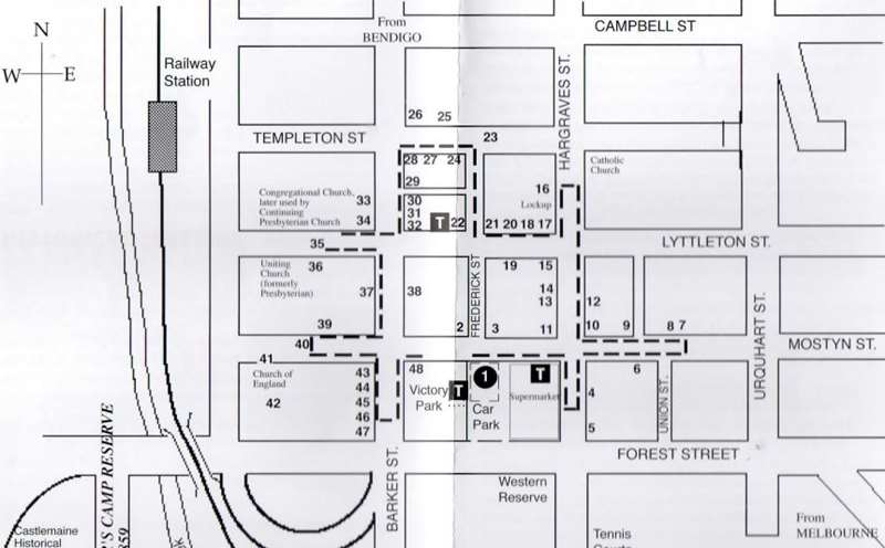
* in text indicates information plaque. The walk starts at the Market Building, 44 Mostyn Street. This is the location of the Visitor Information Centre which has brochures of this walk.
1. MARKET BUILDING.*

Constructed 1861-62.Designed by William Downe, architect. It continued as a market building until 1967. Vendors could back vehicles and unload produce through doorways along the sides into the arched stalls. This was the central building of three, the others running east and west along the Market Square block. Currently used as the Visitor Information Centre for Mount Alexander Shire.
2. A.N.Z BANK, 1856*

Started as the Bank of Australasia. Bank closed in 2020.
3. GOLDSMITH'S HOTEL, 1861,

One of numerous licensed premises in a thirsty gold mining town, is now a chemist.
4. THEATRE ROYAL, c.1855.
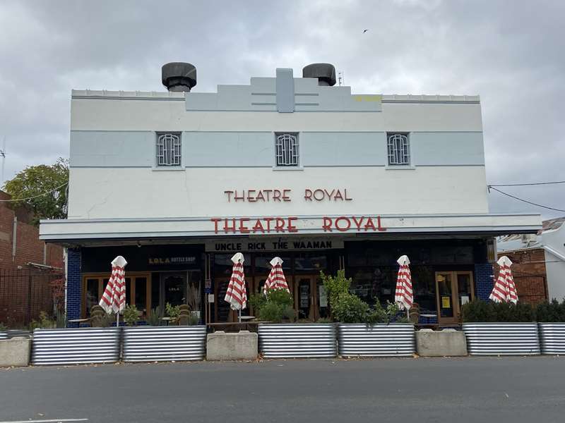
Original building destroyed by fire in 1857, but quickly rebuilt. Behind the 1930s facade is one of the longest continuously operating entertainment establishment in Victoria. Lola Montez performed here. The old stonework of the external walls can be seen from the side Lanes.
5. BUTTERWORTH BUILDING.
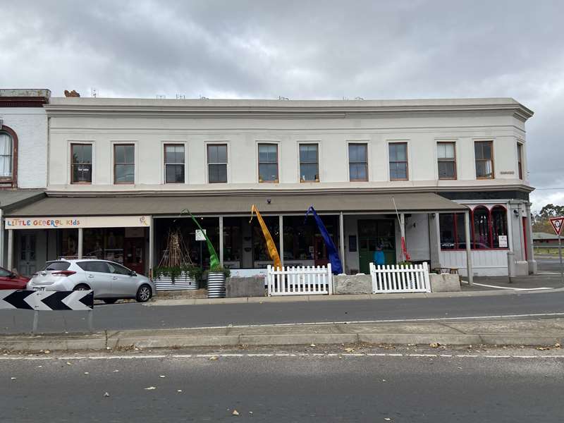
Butterworth's store used tokens in 1857. It became the Commercial Hotel in 1874. Currently used by various shops.
6. ALBION HOTEL.
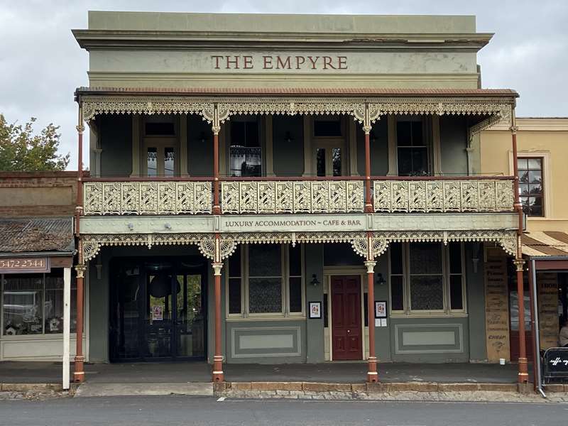
One of three hotels in the block between Hargraves and Union Streets. Evidence of a cobbled coach-way entrance can be seen. Later the Empyre B&B. Now a private residence.
7. MOUNT ALEXANDER HOTEL FROM 1864-1907,

When William James Stoneman took it over as a grocery business. His grandson, Stuart began a chain of supermarkets. Now Restorer's Barn.
8. TRADES HALL. Built c.1860,

and successively an insurance office, shop and then a dressmaker's shop, it became the Trades Hall in 1914. Now used by next door funeral parlours.
9. Signs of name changes can be seen on the facade of a hotel, successive hotels were the Freemason's, Victoria and Sport Club. Later used by a plumber.

10. WILLIAM'S BUILDINGS, 1881.

Originally a single storey collection of shops. Edward David Williams redeveloped the site as his lucrative grocery and general merchandise business. Now a book shop, Stoneman's Book Room.
11. The east wall of the original Government Survey Office, where early Municipal Council meetings were held, has been preserved in this corner shop.

12. PENNEY'S BAKERY. C.1880.
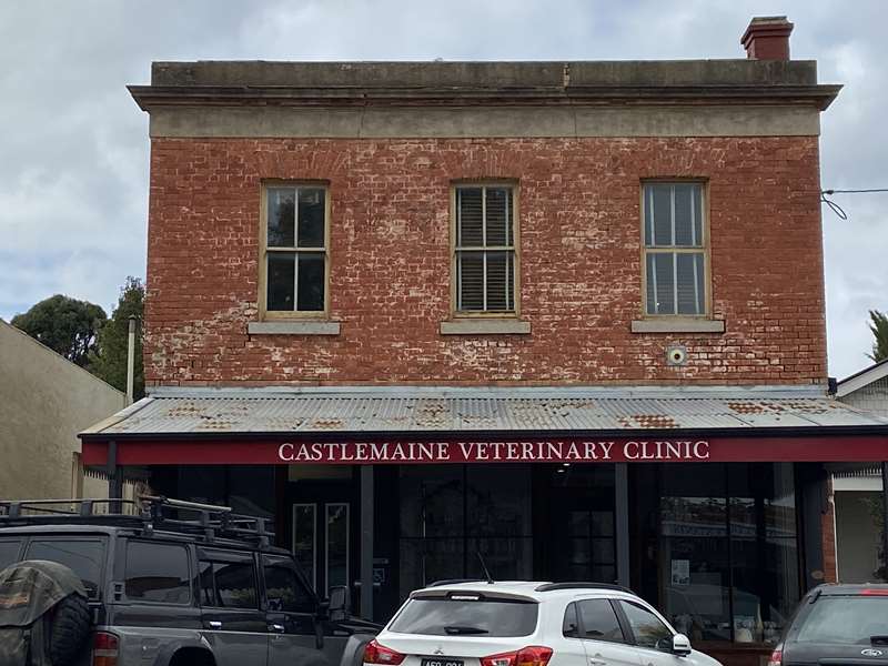
The two storey shop once sold three course meals for an inexpensive 1/3.
13. UNION BANK.* 1859-65
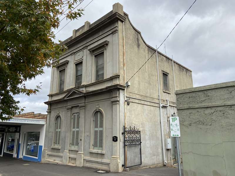
then doctor's residence and surgery. Now a private residence.
14. FRENCH'S TALBOT DRUG STORE* 1858.
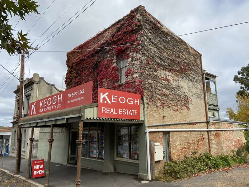
An early chemist shop.
15. SUPREME COURT HOTEL.* 1859-1913,

has extensive cellars. Later Heron's Art Gallery, named in recognition of its philanthropic owner, Miss Heron. Now a private residence.
16. STATE SAVINGS BANK
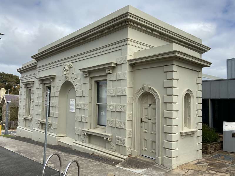
Began in this building with the interesting keystone in 1855. In 1921 it became the police station and the bank moved to the police station site (see No 28)*. Note the poor ventilation in the granite Lockup, to the left, down the hill.
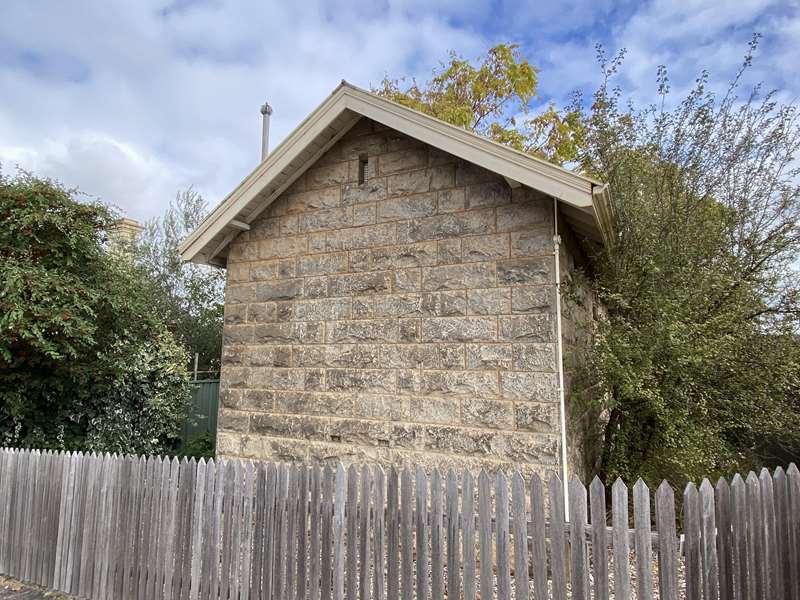
17. GOLD WARDEN'S OFFICE.
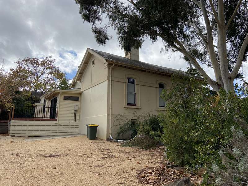
The Warden headed the Mining Court, and also served as a Police Magistrate. Now a private residence.
18. COURT HOUSE, 1877
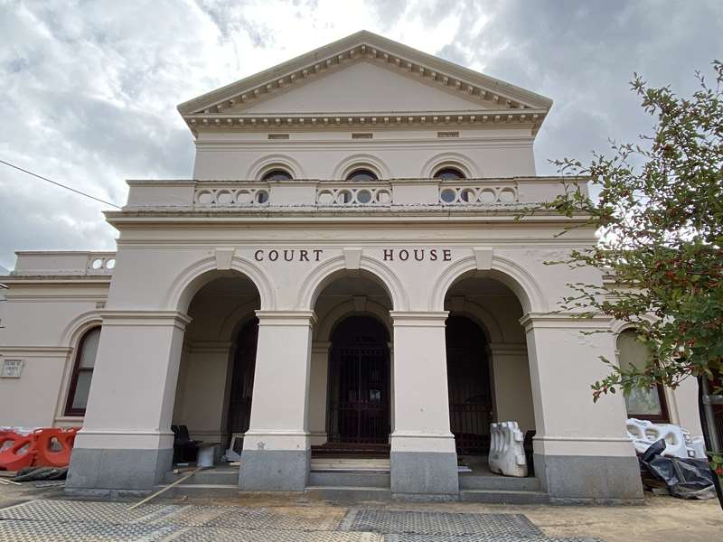
replaced an earlier court building on this site, which itself had superseded the first court house in the Gold Commissioner's camp on the other side ofjohn hep Barkers Creek. That [1852] Former Court House is now the home of the Castlemaine Historical Society Inc.
19. IMPERIAL HOTEL. 1861.
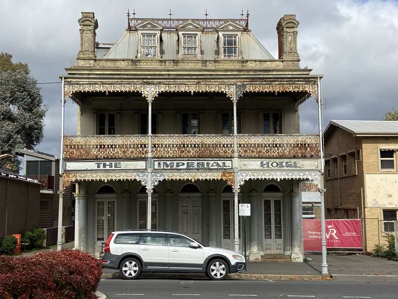
Another of many hotels from the early days, built in grand style with interesting mansard roof and extensive cellars.
20. SCHOOL OF MINES,
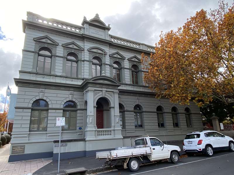
began on this site in 1887 in the old Police Court. Building extended in 1928. Now the central office of Mount Alexander Shire Council.
21. TOWN HALL.
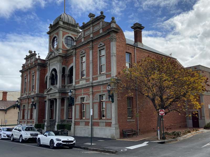
This building dates from 1898, replacing the plainer Municipal Chambers of c.1862 which were located at the rear of building.
22. DRILL HALL. 1889.
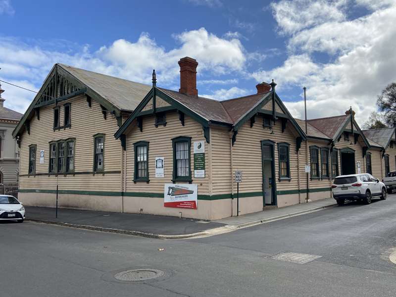
Castlemaine 1st Company, Victorian Volunteer Rifle Corps moved from Camp Reserve to this site prior to 1863. Now a sports fitness centre and indoor pool.
23. This part of Templeton Street was the site of early burials, before the township was surveyed in 1852. In 1856, bodies were disinterred and removed to the Castlemaine Cemetery, Located at Campbells Creek, which had been gazetted in 1853.
24. FIRE STATION

Site from 1857. At the Relief of Mafeking celebrations 1901, an over-enthusiastic ringing of the bell caused it to crack. Station was replaced by a modern CFA complex in Barker Street north in 21st century.
25. These three adjoining buildings were the Salvation Army Officers quarters, Citadel and Barracks between 1885 and 1898. The central building, was reported at the time to be capable of seating 1000.
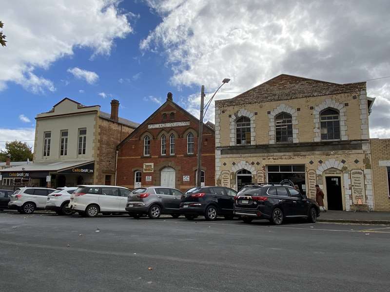
26. On this site the wheels of Major Mitchell's ox cart were visible for many years. Buildings were established in 1900 by Henry Darling McBean who built many public buildings and residences in Castlemaine. Later it became Tonks Timber and Hardware Store and now is a plumbing business.
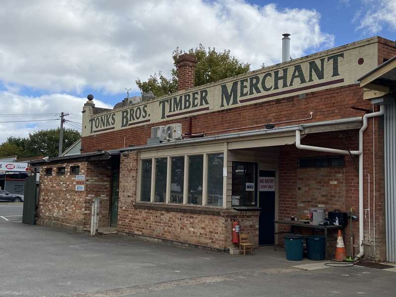
27. The red brick building next to the old fire station is the top floor of the stables used when the police occupied sections of this corner block from 1889. Feed supplies were loaded into the barn area at street level, and the horses were stabled below.
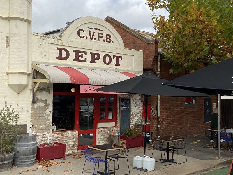
28. STATE SAVINGS BANK.*1920 until 1979.

Foundations of the earlier police station were used and early police cells incorporated into the basement floor when this building was constructed. Now a commercial enterprise.
29. MECHANICS INSTITUTE.
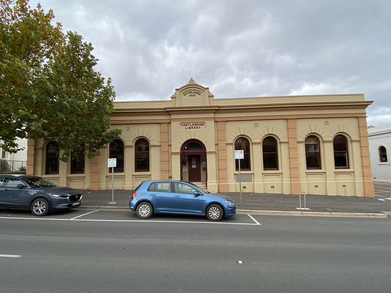
Opened in 1857, which became the CASTLEMAINE LIBRARY. Additions were added in 1861, 1873 and 1893.
30. FAULDER WATSON HALL.

Opened in 1895 as the premises for Castlemaine Pioneers and Old Residents Association (P&ORA) which had been formed in, 1880 to 'promulgate facts relative to the early history of the district: Hall funded chiefly by a donation from Mrs Watson in memory of her husband.
31. TELEGRAPHIC OFFICE*
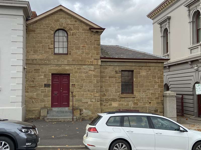
1st telegraph communication sent in January 1857. P8tORA were appointed trustees of the site in 1893.
32. FOREST CREEK POST OFFICE,
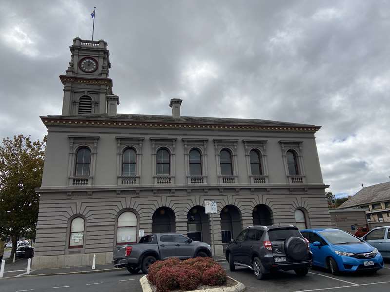
Later called Castlemaine Post Office was located on Barkers Creek in the Gold Commissioners Camp. It was relocated to this site in 1859. A new building was erected in 1875, complete with clock bell cast locally at Horwood's Foundry.
33. GEO CLARKE BUILDINGS.
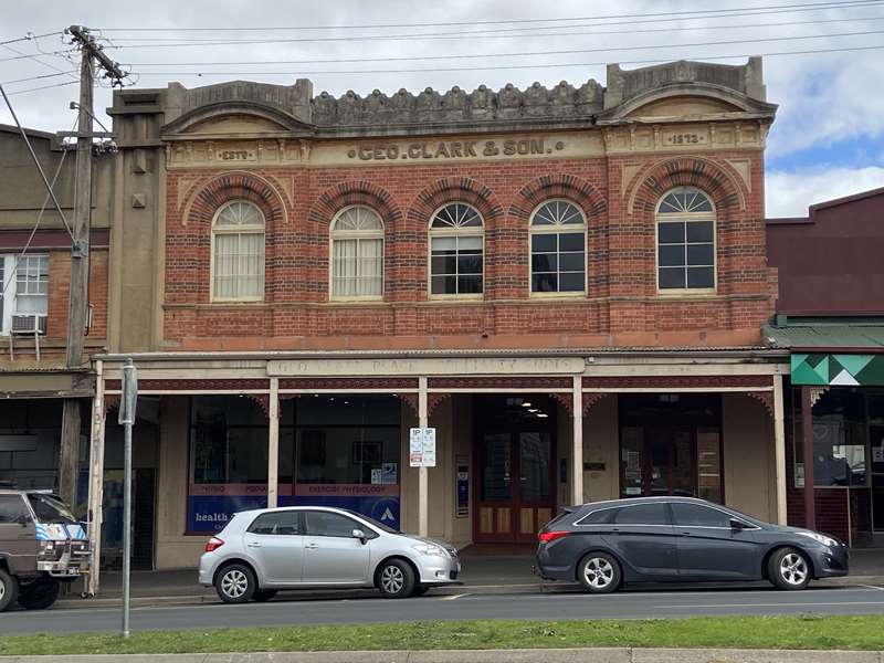
Beginning with a general store out of town, George Clarke prospered and built these premises from which to conduct his wide ranging business. Arcade developed in the fate 20th century.
34. VEREY'S CORNER.

Occupants have been decorator, photographer, confectioner, photographer, then a chemist. Verey's first photograph studio here circa 1884, and built new premises in early 1900s.
35. SIR HARRY LAWSON bust.
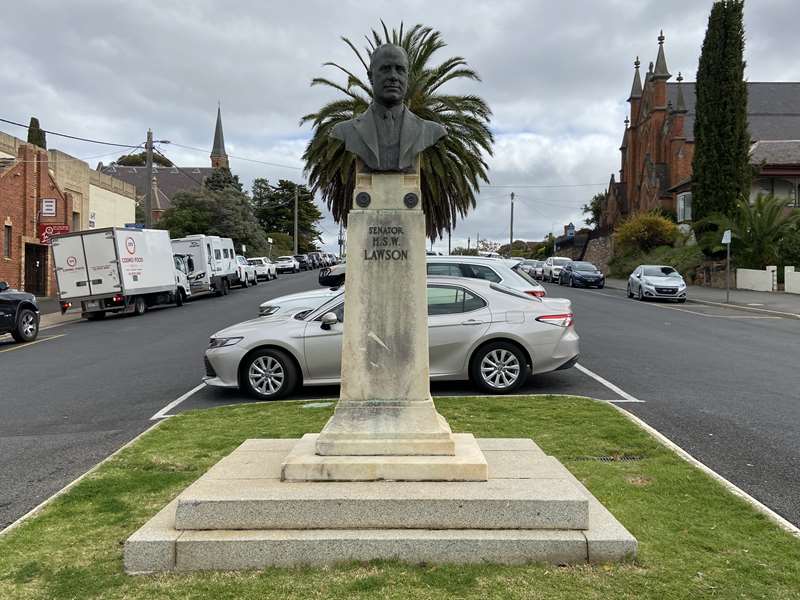
Premier of Victoria 1918-1924, and late a Senator.
36. CASTLEMAINE ART GALLERY & HISTORICAL MUSEUM, 1930-31.

Committee was formed in 1913. Now called Castlemaine Art Museum.
37. ODGERS & CO.

Family enterprises in timber/hardware and undertaking operated on this site from 1879-1987. Now Home Hardware and Lyal Eales Store.
38. BALL & WELCH STORE
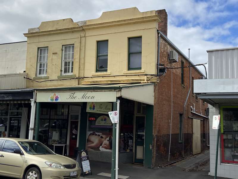
Moved here from their original store in Vaughan, prior to establishing department stores in Melbourne. Later Coles Department store and now a merchandise store.
39. FITZGERALDS of CASTLEMAINE XXXX

Had their office and house on this site in 1857. From c.1909 to c.1940 it became "BALLARA" a private hospital and is now a medical centre.
40. SOUTH AFRICAN WAR MEMORIAL.* 1899-1903.

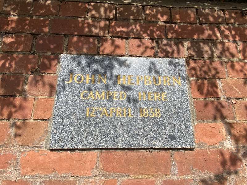
41. John HEPBURN* camped here in 1838, prior to the gold rushes, on his way to establish his pastoral run further south west at Smeaton.
42. AGITATION HILL. Here diggers held protest meetings about the gold licence system prior to Eureka.
43. CRITERION HOTEL 1853.

Originally a wooden building it was the oldest continuously licensed premises in Castlemaine. At the rear section of adjacent brick building was a Music Hall. Later became the Public Inn.
44 - 47. This row of substantial bank buildings bordering what was then Market Square indicate the wealth being wrung from the surrounding gullies and the expectations held for the future of Castlemaine in the 1850s and 60s.
44. BANK OF VICTORIA.* 1856,
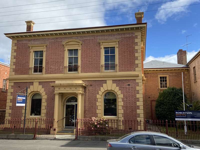
Replaced the 1855 single storey building.
45. ORIENTAL BANK CHAMBERS. 1862.

Subsequently, printing works, newspaper office, legal chambers and art gallery.
46. BANK OF NSW* 1866,

Replaced the 1855 single storey building. Now a private residence.
47. BEDFORD ARMS HOTEL.
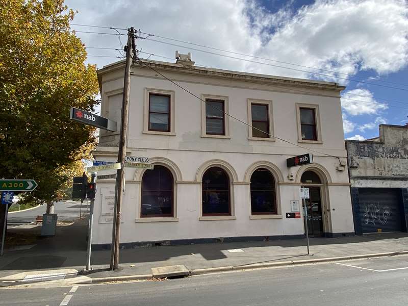
In 1860 it became the NATIONAL BANK.
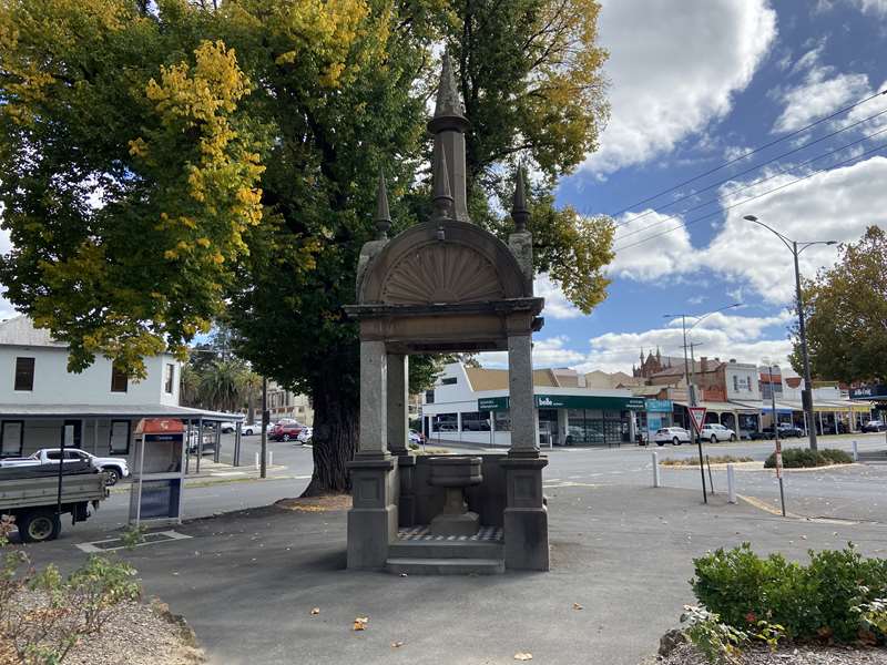
48. VICTORY PARK, established 1919 and the 1896 Sir James Patterson memorial.* This corner was the popular meeting place for political campaign meetings and also the scene of auction sales of stock. Patterson was Mayor of Chewton, then MLA and Premier of Victoria 1893-94. The unique drinking fountain provides for horses and dogs as well as humans.
Historical Timeline of Castlemaine
1853 - First land sales of town allotments
1853 - Castlemaine gazetted as a township
1855 - Proclaimed a Municipal District
1855 - Municipal Council proposed
1856 - First Municipal Council elections
1858 - Goldfields officials and Military withdrawn
1863 - Constituted a 'Borough'
1950 - Created a 'Town'
1965 - Declared a 'City'
1996 - Local Government Amalgamations: Castlemaine joined with the shires of Maldon, Newstead and Metcalfe to become the Mount Alexander Shire.
Origins of Street Names
Urquhart Street
William Swan Urquhart was a prominent Government Surveyor for this district. He planned the town in 1852 and selected sites for the hospital, market square, gaol and churches.
Hargraves Street
Edward Hammond Hargraves was the first discoverer of gold in Australia. He visited Castlemaine in November 1852, when the town survey was approaching completion.
Barker Street
Dr William Barker was a pioneer settler, on whose pastoral run gold was first discovered in the Mount Alexander area.
Mostyn Street
Commissioner Henry Porter Mostyn was in charge of the camp at Fryers(town) and afterwards appointed Inspector of Police in the district.
Lyttleton Street
Lieutenant Thomas Lyttleton was a member of the goldfields police. He later became Inspector of Police and was succeeded by Robert O'Hara Burke.
Templeton Street
William Templeton was a Gold Commissioner at Castlemaine.
Campbell Street
William Campbell was a pioneer pastoralist who occupied Strathloddon Run, amongst many other runs throughout Australia.
Forest Street
Known firstly, as Forest Creek Road because it followed Forest Creek, which at that time coursed through dense bush.
Text prepared by the Castlemaine Historical Society
Photos:
Location
44 Mostyn Street, Castlemaine 3450 View Map


