Carisbrook Significant Historic and Heritage Sites

The Dja Dja Wurrung were the First People of this area, with the Wurn Balug (the boomerang clan) in the Carisbrook district.
White squatters occupied the area is the 1840's following Major Mitchell's report on the land he crossed on his way back to Sydney. A party under William Urquhart surveyed along Tullaroop Creek and its confluence with Mt. Greenock Creek for the new settlement of Carisbrook in July 1851.
Government officials were appointed and a police camp, goal and courthouse were erected in Carisbrook and shopkeepers, publicans and tradespeople established businesses here. In 1859 the Borough of Carisbrook was promulgated and a Town Hall and Market Hall were erected. Other construction included a flour mill and two breweries.
The railway reached Carisbrook in 1874, and this assisted local graziers and farmer selectors with the transport and sale of livestock and agricultural products. Large goldmining companies developed mines on the district's deep leads from 1870 to 1908 and Carisbrook prospered and grew.
This was followed by a long period of population decline and in 1915 Carisbrook was amalgamated with Majorca into the Shire of Tullaroop with a Maryborough headquarters.
In the 1930's to the 1950's, new industries such as egg producers and depot, chicken hatcheries, and 3CV Radio Station opened up, followed by a Bluestone Quarry, Feed Mills, Hydroponic Glasshouses, an Abattoir, and Engineering Works in the 1970 to 2020 period.
Carisbrook has a significant heritage with many surviving bluestone buildings and structures, for which the stone was quarried locally. Many prominent buildings in Carisbrook were constructed with locally manufactured bricks.
Carisbrook has had its economic ups and downs in its history but has shown resilience within its community, and has more than doubled its population to over 1,100 since 1960.
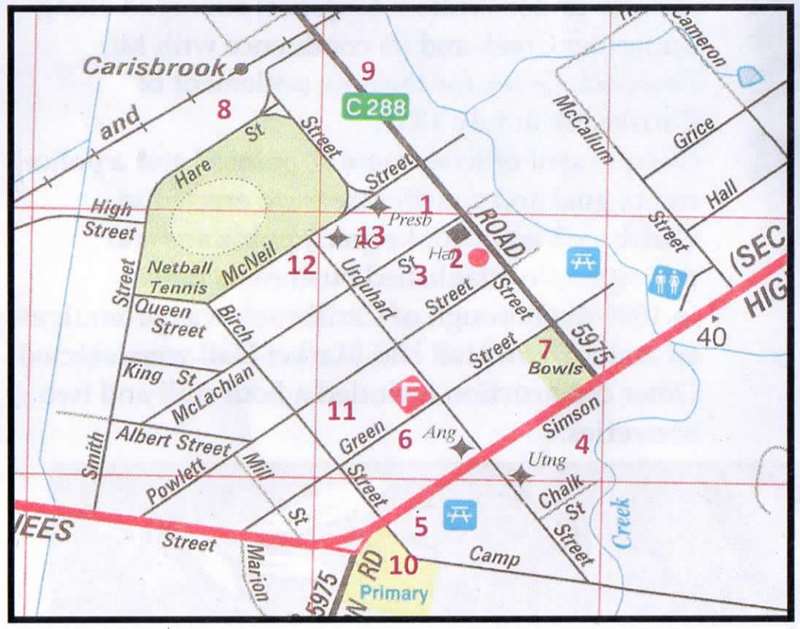
Significant Historic and Heritage Sites Map
1. Police Residence:
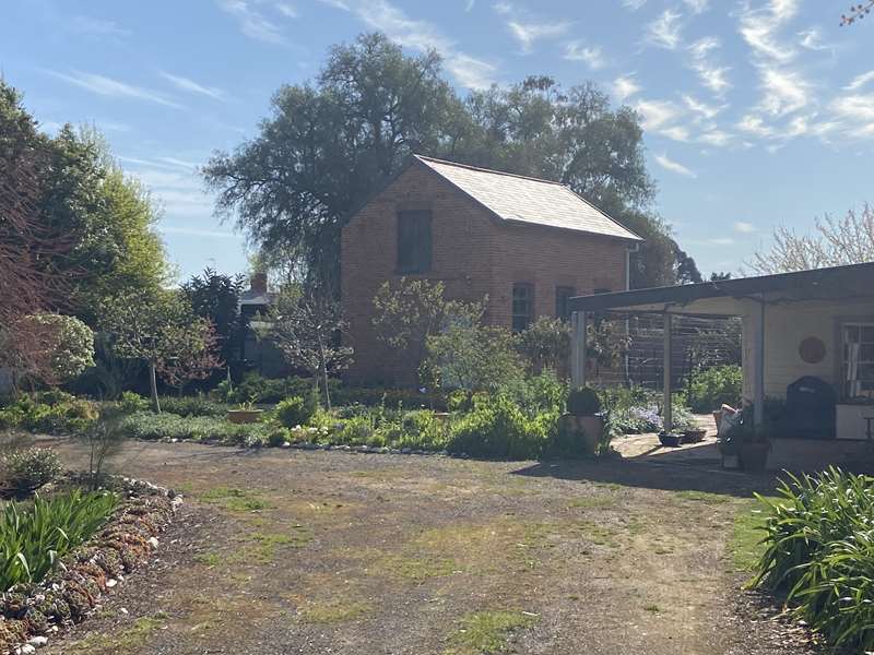
In 1881 the residence and stables were moved to this site from the Police Camp to be near the courthouse. Carisbrook Court closed in 1915. Now a private residence.
2. Post Office:
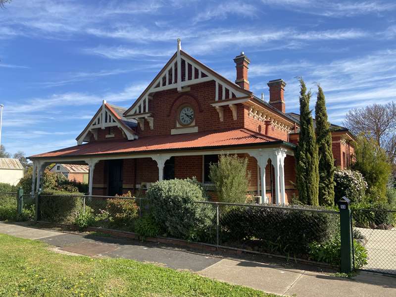
Postal services began at Carisbrook in 1852 and were conducted in several businesses until 1874 when the Railway Station opened. From 1888 postal and telegraph services move to the Post Office. After 134 years services moved to a new site in Simson Street, now a private residence.
3. Carisbrook Town Hall:
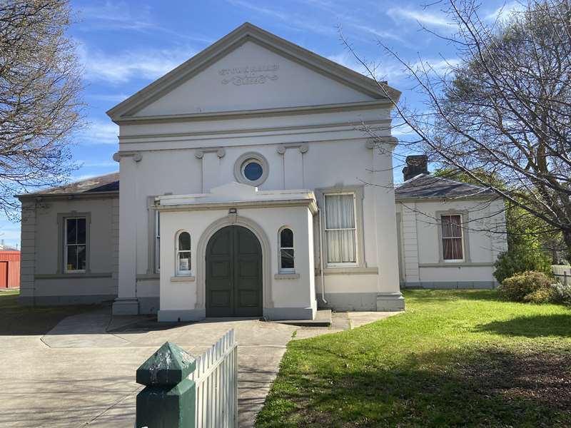
The original 1859 facade. It was extended in 1892 and closed 1915 with LGA amalgamation. It is now a Public Hall used for markets and meetings.
4. Tilly Aston Memorial & Sensory Garden:
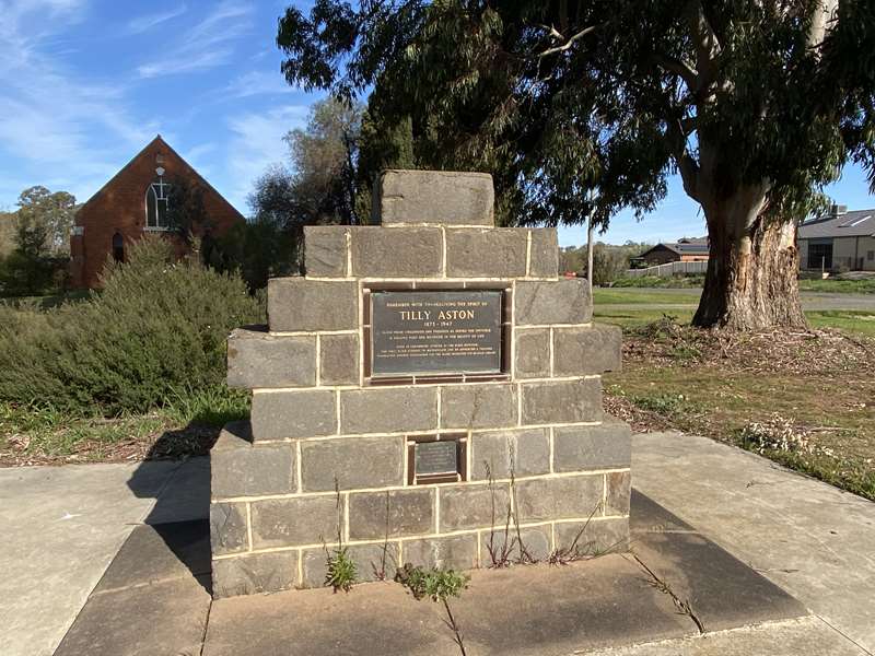
To commemorate the most renowned person born (1873) in Carisbrook, Matilda (Tilly) Aston, the bluestone marker was installed in 1970. Tilly was blind but achieved much for the blind in Victoria including her contribution to The School, and the Braille Library.
5. Carisbrook War Memorial:
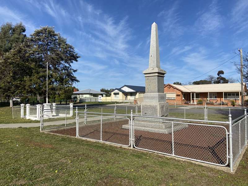
The memorial was unveiled in 1921, and includes the names of all the local war deceased from the Boer War , WWI & WWII.
6. St Paul's Anglican Church:
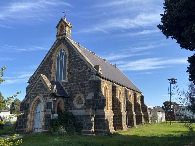
This bluestone and white brick Anglican Church was consecrated in 1866. Built from funds raised by the congregation from mining company dividends. The building features buttresses, a bell tower, and metal finial; now privately owned.
7. Carisbrook Hotel:
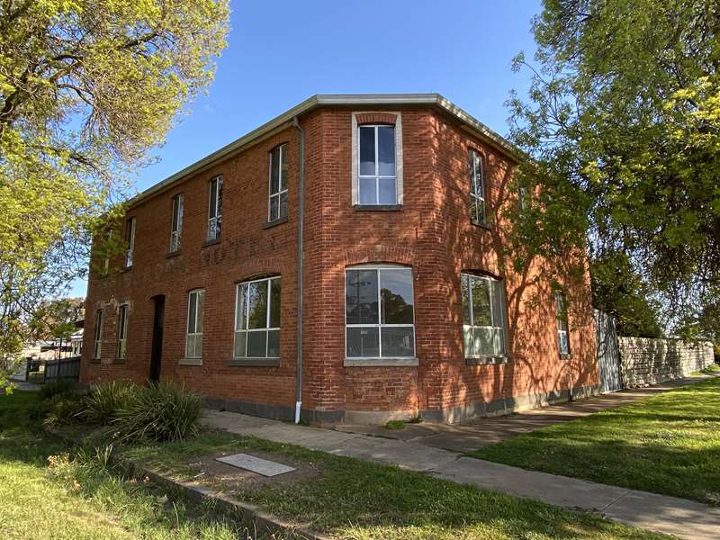
This double-storied brick hotel (1856) was one of many locals. It closed in 1914 prior to becoming an egg depot; now a private residence.
8. Railway Station:
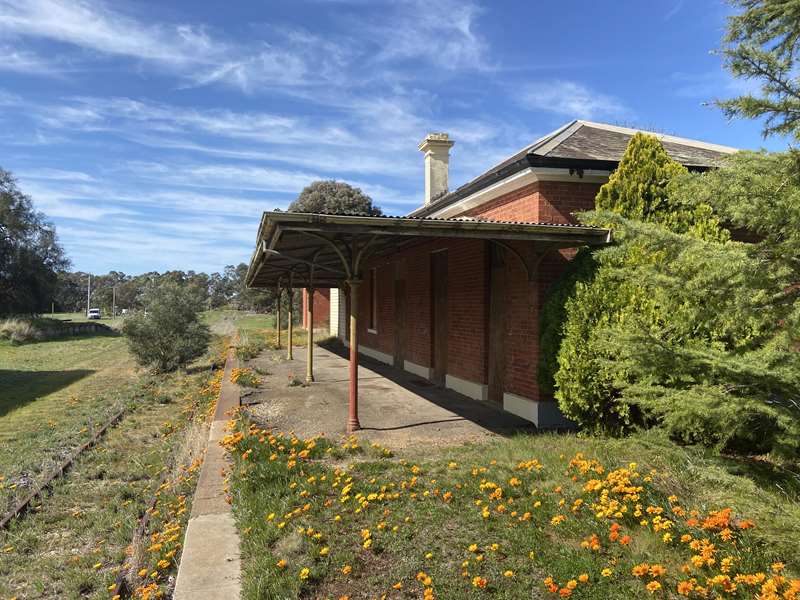
Built in 1874 with the Castlemaine to Maryborough Railway. The Good's Shed also remains. Hay, grain, blue-metal, mine gravel and livestock were the main products carried. The line was closed in 2004.
9. Carisbrook Log Jail:
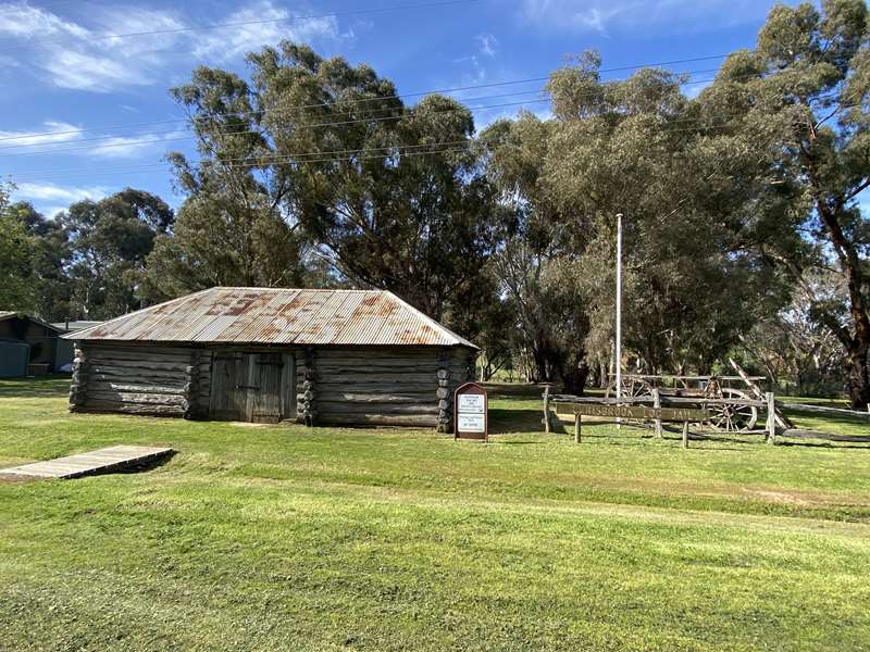
The Jail was built in 1851 at the Police Camp. Later it was moved to the current site and was used as a lucerne storage shed. It is one of only five such surviving jails and the Historical Society opens it for viewing most days 10am-4pm.
10. Carisbrook State School No. 1030:
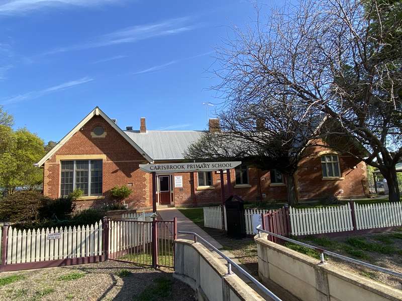
Opened in July 1874 and replaced the 1864 Common School. A headmaster's residence was also erected in 1874. Both buildings were constructed from Sandhurst Bricks.
11. Market Reserve:
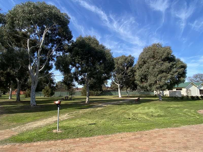
The Council reserved this block in Green Street for a Town market in 1859. The Council erected a market building but as it was uneconomical, the building was leased to various businesses including Stock Saleyards, Senior Citizens Clubrooms, Scout Hall, Fire Station, Units, and Op Shop.
12. Saint Francis Xavier Mission Church:
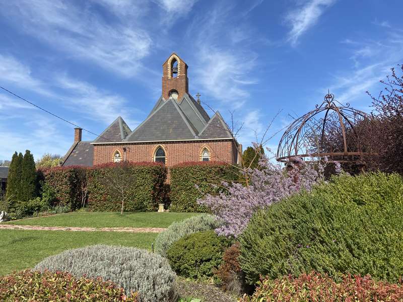
This Mission church was opened in 1865 for the Catholic Parish that extended as far as Swan Hill. Now a private residence.
13. Carisbrook Court House:
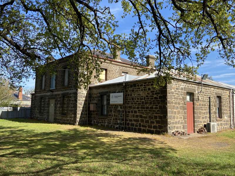
Built in 1859 to replace a slab courthouse at the Police Camp. It was sold in 1925 to the Carisbrook Masonic Lodge who still hold meetings.
Content provided by the Carisbrook Historical Society.
Photos:
Location
42 Bucknall Street, Carisbrook 3464 View Map


