Bendigo - No. 7 Reservoir and Park

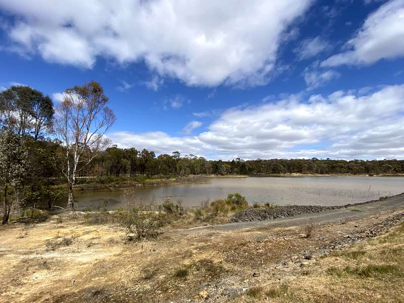
No. 7 Park, which has a reservoir, is a popular destination for cycling, walking, jogging and picnicking. The park has excellent historical elements from the days of gold mining and Bendigo's early water treatment facilities.
The Number 7 Park is a very important part at Bendigo's gold mining history. The cleverly designed reservoir and water purification system was the first of its kind in Australia in supplying drinking water to Bendigo's gold miners of the 1860s. The settling ponds, the basin and channel system can still be seen today as you journey around an interpretative walk surrounded by Box Ironbark forest.
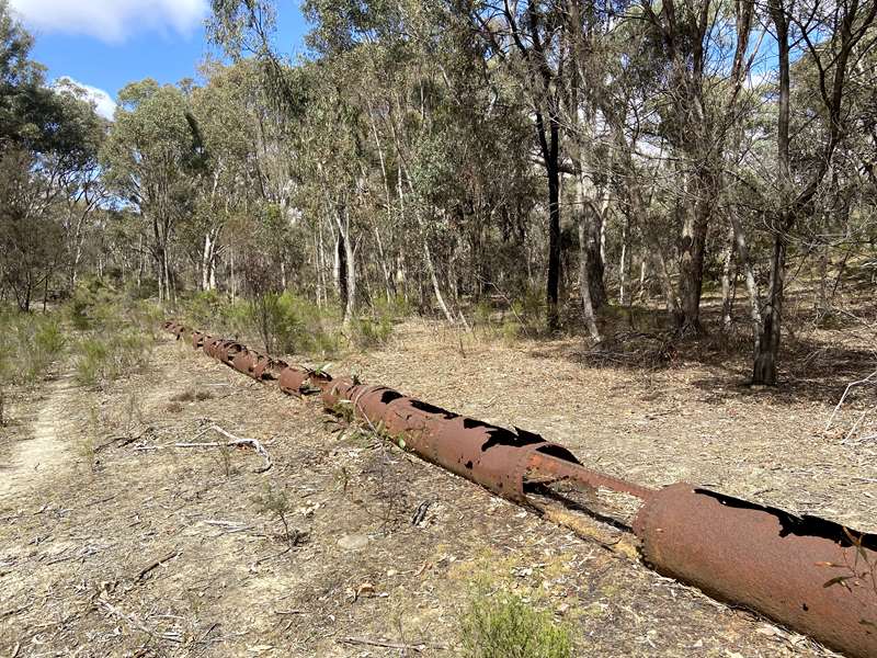
Why Number 7? The name Number 7 comes from the labelled series of 8 reservoirs designed by Joseph Brady to provide Bendigo with drinking and mining water in the early 1860s. After the completion and failure of the Number 1 Reservoir, the Number 7 Reservoir and water filtration system was the next built, completed in 1862. the larger capacity Crusoe Reservoir was later built in 1873 with an improved filtration system.
The area is surrounded by the Greater Bendigo National Park and is known for its beautiful landscape, indigenous vegetation, rich cultural heritage and recreational opportunities.
The No. 7 Reservoir is an established conservation area and cannot be used for fishing. This reservoir is home to many species of flora and fauna including the Freshwater Catfish, which in Victoria has been classified as a vulnerable species.
Facilities include wide shared paths, toilets, tables, seating and parking. Near the car park is a huge shelter with four tables, three unshaded tables, toilets and grassy area.
Crusoe Reservoir and No. 7 Reservoir and Park Map
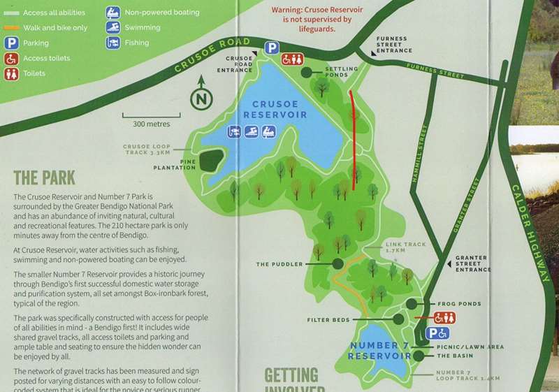
Walking / Cycling / Jogging
For jogging and cycling there are a series of measured jogging and cycling tracks which are sign-posted and colour-coded (we weren't able to find a good map of these but there were plenty of poles with coloured numbers on them).
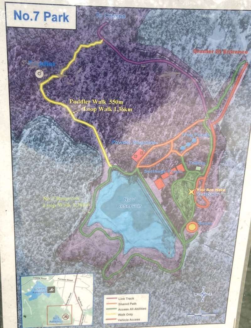
This map which is located at the car park shows the main tracks and location of the historical elements including Settling Ponds, Basin, Powder Magazine, Frog Ponds, Reservoir and Puddler.
Historical Elements
There are a series of information panels which highlight the history of the area including the reservoir, water treatment works, channel system, cistern, basin, puddler and detonator / powder magazines, native grass lawn and frog ponds.
No. 7 Reservoir
With the discovery of gold and the establishment of Bendigo as a city in 1851, there was high demand placed on water for consumption and mining practices. As Bendigo is not situated on a river and what little water in Bendigo Creek becoming polluted due to mining practices, drinking water was scarce.
This led to the formation of the Bendigo Waterworks Company who in 1858 commissioned Joseph Brady, an Irish engineer, t design and supervise construction of the No. 7 Reservoir.
No. 7 Reservoir was one of 8 reservoirs (6 for mining and 2 for domestic). Construction of the reservoir was completed in 1861 with a capacity to hold 270 million litres of domestic water to supply 15,000 Bendigo residents. At this time, Bendigo's water consumption was at 160,000 litres per day.
The No. 1 Reservoir was built in 1859 across the Bendigo Creek at the corner of High and Maple Streets. However it leaked and was soon decommissioned.
Joseph Brady then went on to build No. 7 and abandoned plants to build the remaining 6 reservoirs.
No. 7 Treatment Works
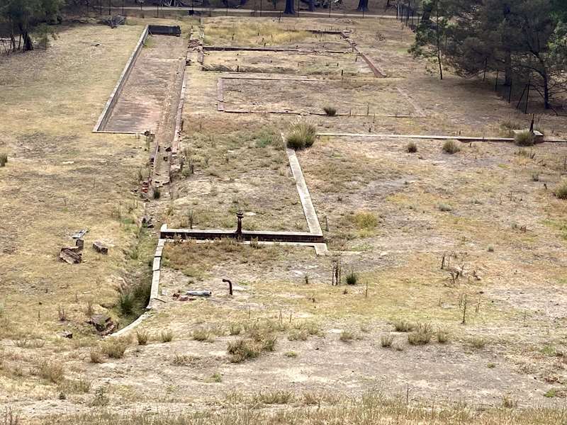
Along with the No. 7 storage reservoir, Joseph Brady also designed and constructed a water purification system consisting of lime settling ponds, filter beds and an underground brick cistern.
The filter beds ceased operation between 1887 and 1907 and were later filled around 1939. The treatment facilities are now listed on the Victorian Heritage Register.
The purification process started by adding lime to the water to remove suspended clay particles. Water then flowed to the filter beds where it leached through beds of sand, gravel and 12" perforated tiles to then carry to the underground cistern where it was gravity fed to Bendigo.
The resulting water would appear clean, however this treatment could not kill off any harmful microorganisms.
The Channel System
In 1862 to cope with growing population and mining demands The Victorian Government offered a 500 pound prize for the best solution to bring a more permanent water supply from the Coliban River to Bendigo.
Joseph Brady won this prize and designed a gravity fed channel stretching approx. 70km from Malmsbury through Elphinstone along the eastern slopes of Mt. Alexander to Bendigo.
The first flows along this channel occurred in 1977 when the Malmsbury Reservoir was completed.
At this junction a 28km pipeline from Eppalock feeds into the Coliban System. This water is pumped by hydraulic turbines and can provide up to 15,000 ML p.a.
The channel is still used today providing irrigation water to farmers north of Bendigo, however flows into No. 7 and Crusoe have now ceased. The Rural Supply System now comprised over 500km of open channel varying from concrete lined box section, to earthen channel to pipeline.
The Basin
What was it used for?
The function of this round brick-lined basin remains a mystery. It was fed via an underground pipe from the adjacent channel and held 554,000 litres of water.
The Basin has been dated to have been built in 1876, around the same time as the Coliban Channel. One theory is that it was built as a third settling pond, or as a header tank to flush out the lime settling ponds.
Another theory is that it was used as a header tank to provide large volumes of water quickly for fire fighting purposes.
The Cistern
The Underground water cistern was built as part of the No 7 water purification system. It is believed the cistern was built to store the clear drinking water after purification. It was then released through wooden pipes to Bendigo. As the site was 44 metres above Pall Mall the water was gravity fed.
The Cistern measures 15 metres long by 17.5 metres wide by 5 metres high. Built in brick it is divided into 15 section (5x3), each with a vaulted roof supported byy brick pillars. The cistern can store up to 340,000 litres water.
Along with the filter beds the cistern ceased operation between 1887 & 1907. The Cistern was rediscoverd in 1964 when a backhoe broke through the roof.
Puddler
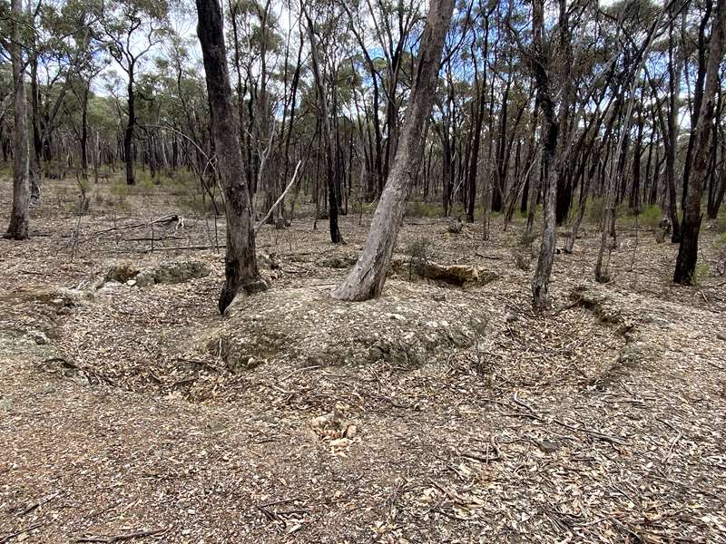
Here lies the remains of a horse driven puddling machine which was used during the harvest of gold in these gullies.
The puddling machines consisted of a circular structure dug into the ground, usually about 7 metres in diameter with the hole about 1 to 1.3 metres wide.
A central mound which had a large wooden pole erected vertically and another wooden pole that was horizontal and attached to metal rake designed to rake and break up the gold bearing dirt. A horse was harnessed to complete this task, by walking around and around the puddler.
Puddling machines processed four times more sludge than a hand puddler. They created havoc in the creeks of Central Victoria as the fine sludge they produced would make its way into the waterways causing pollution.
The Detonator and Powder Magazines
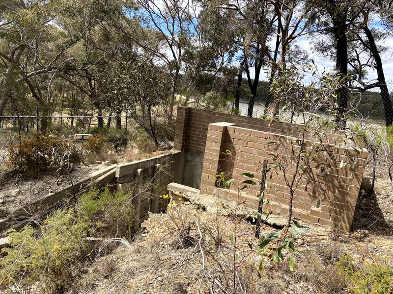
Black Powder was used in the construction of the reservoirs, it is an extremely volatile and unstable substance that required the greatest care when handling and storing.
The detonator and powder magazine were used for the safe storage of explosives used in the construction phase of the No. 7 Reservoir and water system.
Native Grass Lawn
Due to the continuing drought, the City of Greater Bendigo has embarked on a project to establish a native grass lawn area.
A first for the Council, three varieties of native grass have been sown, two cool season grass, Weeping Grass Microlaena Stipoides, and Bristly Wallaby-grass Austrodanthonia setacea and a warm season grass Red Grass Bothriochloa macra providing green grass all year round.
Native grass lawn will endure under our extreme weather conditions requiring minimal water, and can grow in low fertility soils while providing great foliage cover.
Bendigo Creek - the way it was
This map (on the sign), sketched by an early miner, represents his account of the Bendigo Creek when gold was first discovered in 1851. The No. 7 Park Frog Ponds have been created based on this map and subsequent historic records describing the abundance of flora, fauna and the character of the Bendigo Creek, attempting to replicate "the way it was".
"The flats carpeted with green grass, were dotted here and there with comely and shady gum-trees, while the creek banks, shaded with wattle, sloped down to a chain of water holes, which, in the spring and winter seasons, and indeed all the year round, before the gold era, contained a good supply of sweet clear water. Down about the now desolate-looking Epsom, the valley wore a really picturesque appearance ;the gum trees were very fine, and the wattle flourished luxuriantly". Described by Mr. Robert Ross Haverfield a former editor of the Bendigo Advertiser 1870. G.Mackay (1912).
"On the Sunday morning, a lovely day, we took a stroll to the junction of what have since been known as Back Creek and Bendigo Creek, and thought it the loveliest spot on earth, with waterholes with water in them as clear as crystal, kingfisher birds flitting about in the silver wattle, whose foliage almost hid the banks of the creek from view, with occasional splashings as the duck-billed platypus tumbled from the banks into the water. But there was not a human being to be seen anywhere". 'Mr. Tomas Dungey', G. Mackay (1912)
"It was 1851 and spring had already come to the valley. The waters of old Bendigo Creek, muddied with yellow clay from the winter rains, were clear again. Wattles glowed along its banks and the bush around was splashed with flowers - purple sarsaparilla cascaded over the rocks; there were starry bushes of waxplant, and furry, red spider-flowers glowed among the tussocks. The air was honey-sweet and vibrant with bird calls - the plaintive piping of the cuckoo, thrushes calling and leatherheads beating out their ripple of song and along the creek, parrots, scarlet, blue and emerald, dipped and flickered amongst the gums". F. Cusack (1973)
Frogs of the Park
15 of the 36 species of frogs listed in Victoria, occur within the Box-ironbark region. These frogs are separated into two families, the southern frogs (Hylidae, 11) and tree frogs (Myobatrachidae, 4).
The 10 species pictured have been recorded in this Park. Typical frog habitat includes waterholes, low-lying depressions and moist gullies. Some shelter beneath debris while others underground in burrows, awaiting rain.
Frogs range in size from the small Common Froglet 20-30mm, to the 85mm Growling Grass Frog.
Opening Hours:
Number 7 car park is open between 8:00 am and sunset. The vehicle entrance gates to the car park are shut and locked at sunset. For locked vehicles penalties to get out will apply (call 0439 365 089).
Access for Dogs:
Dogs are not permitted in No. 7 park.
Restrictions:
In addition to no dogs, camping, boating, swimming, fishing, fires and motorcycles are prohibited.
Water Quality Alert - Water quality within the No.7 Reservoir has found to be unsuitable for human consumption and contact. DO NOT drink the water, avoid contact with water and no fishing in the Reservoir.
Location:
No. 7 Park/Reservoir is accessed at the southern end of Granter Street (near the intersection with Hammill Street). The park is on the Bendigo Creek Trail.
Photos:
Location
Crusoe Road, Kangaroo Flat 3555 View Map
Web Links
→ Friends of Crusoe Reservoir and Number 7 Park on Facebook


